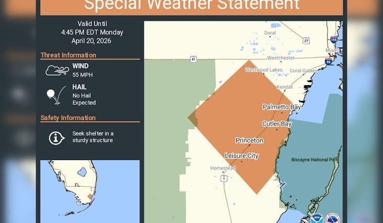
The National Weather Service office in Miami spent part of Monday sounding the alarm for southern Miami-Dade, issuing a special weather statement for Cutler Bay, South Miami Heights and Palmetto Bay that called out gusty thunderstorms and pockets of potentially damaging wind. The statement was posted as valid into the mid-afternoon, with an expiration time of 4:45 p.m. EDT.
Special weather statement issued for Cutler Bay FL, South Miami Heights FL and Palmetto Bay FL until 4:45 PM EDT
— NWS Miami (@NWSMiami) April 20, 2026
What Forecasters Warned
Forecasters said the strongest storm cells could crank out brief but intense wind gusts, with reports of winds up to 55 mph, while hail was not expected, and they urged residents to get inside sturdy buildings, according to NWS Miami. The notice also flagged a wide swath of the metro area, naming neighborhoods and nearby points of interest from Doral and Westwood Lakes across Coral Gables, Kendall and Miami to Biscayne National Park as places that could see the rowdiest weather.
Local Outlook And Marine Impacts
The Miami forecast office said a cold front sliding through the region would fire up scattered showers and thunderstorms during the afternoon and kick up hazardous beach and marine conditions, including an elevated rip-current threat, per the National Weather Service Miami. Local meteorologists also flagged the potential for brief heavy downpours, reduced visibility and gusty winds that could make both driving and boating hazardous, CBS Miami reported.
How To Stay Safe
If you are in the areas highlighted by the statement, bring in or secure loose outdoor items, avoid parking under trees and head indoors until the storms move through. Boaters and beachgoers should follow any small-craft advisories and rip-current warnings and keep an ear on updates from local broadcasters and NWS Miami until the special weather statement expires.


