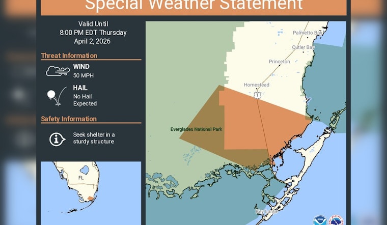
Strong evening storms muscled into Miami-Dade County on Thursday, prompting a Special Weather Statement that put neighborhoods from Palmetto Bay to Key Largo on alert for gusty winds through 8:00 PM EDT.
The advisory called out Palmetto Bay, Cutler Bay, Princeton, Homestead and Key Largo as directly in the path of the roughest weather. While hail was not expected, forecasters warned that strong thunderstorm winds could snap small limbs and send anything not tied down flying, urging residents to ride it out inside sturdy buildings until the storms move on.
A special weather statement has been issued for Miami-Dade County, FL until 8:00 PM EDT
— NWS Miami (@NWSMiami) April 2, 2026
What the NWS warned
According to NWS Miami, the Special Weather Statement for Miami-Dade was in effect until 8:00 PM EDT and specifically named Palmetto Bay, Cutler Bay, Princeton, Homestead and Key Largo. The notice emphasized that hail was not in the cards, but it did urge residents to “seek shelter in a sturdy structure” while the storms pass. Officials also cautioned that pockets of strong wind could flare up quickly with little lead time.
Wind threat and likely impacts
Forecasters said wind gusts in the strongest cells could reach about 50 mph, enough to knock down small tree limbs, toss around lawn furniture and trigger brief power outages. That level of damage is routinely flagged in hazard products for South Florida. For radar views and the latest products, check the National Weather Service Miami office. Drivers of high-profile vehicles were advised to use extra caution on wet roads, and property owners were urged to secure loose outdoor items ahead of the strongest bursts.
How to stay safe
If you are in the warned areas, bring pets and unsecured outdoor items inside and avoid parking under trees. If you hear thunder, move into a substantial building and stay away from windows, guidance echoed by the American Red Cross. Wait at least 30 minutes after the last rumble of thunder before heading back outside.
Where to get updates
For the latest information, follow the NWS Miami feed and keep an eye on the National Weather Service Miami page for updated products and radar imagery. Local TV and radio, along with NOAA Weather Radio, will carry any new warnings if the situation escalates. Residents should contact emergency services if they encounter downed power lines or significant wind damage and stick with official channels until the statement expires at 8:00 PM EDT.


