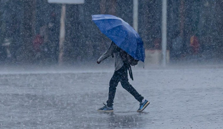
Thursday, April 2, 2026, starts off gray and sloppy in Milwaukee, with light rain, patchy fog and temperatures hovering near 34°F. Visibility is down to about four miles, and while the numbers on the thermometer look tame, the mix of soaking rain, gusty winds and possible strong thunderstorms is set to make for a messy day on the roads and sidewalks.
Showers, Thunderstorms And Icy Spots
Rain will stick around through the morning before ramping up into more widespread showers and thunderstorms by late morning into the afternoon, with heavier bursts capable of dropping 1 to 2 inches of rain. The National Weather Service expects southeast winds of 10 to 20 mph with gusts to around 30 mph, and says storms this afternoon into Thursday night could turn strong to severe in spots.
Counties north of Interstate 94 are under a Winter Weather Advisory for light ice accretion, mainly on elevated and untreated surfaces, with 0.1 to 0.2 inches of ice buildup possible and travel impacts anticipated for the Thursday morning commute. According to the National Weather Service Milwaukee/Sullivan, the primary hazards where storms intensify include damaging wind, hail and isolated tornadoes.
Commute Advice
Plan on slowdowns and ponding on roads when the heavier rain moves through, with quick-hit urban flooding possible where storm drains back up. Before heading out, check live conditions and any closures on 511 Wisconsin, and budget extra time for detours, slower traffic or bus delays.
Afternoon Winds And Lake Hazards
Southerly to southeasterly winds will grow more gusty through the afternoon. A Gale Warning on much of Lake Michigan points to dangerous conditions for boats and shoreline activities, with frequent strong gusts and abrupt wind shifts expected. Nearshore waters are also under a Small Craft Advisory, and thunderstorms over the southern lake could kick up sudden squalls and high waves.
Boat operators, fishermen and beachgoers are urged to stay off the water Thursday into Thursday night and to secure loose items along marinas and shoreline parks.
Looking Ahead
Once the cold front slides through, Friday turns cooler and partly sunny, with highs in the upper 40s. Forecast trends keep additional rounds of showers and thunderstorms in play from Friday night into Saturday. If you are banking on outdoor time this weekend, be prepared for soggy conditions and gusty winds on Saturday, with drier weather favored by Sunday.


