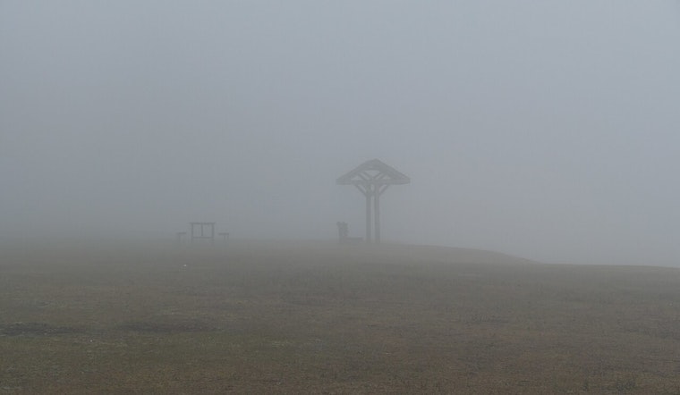
New Orleans rolled into Sunday, May 10, 2026, under a thick blanket of fog at the Lakefront, with visibility cut to roughly a half mile and temperatures hovering near 68°F. The gray start will not last all day, though. Forecasters expect the fog to thin after sunrise, trading low clouds for a warm, muggy afternoon with highs climbing into the low 80s.
Fog, Heat And Afternoon Showers
A Dense Fog Advisory is in effect through 9 AM CDT Sunday for low-lying parts of the metro, so early drivers can expect pockets of reduced visibility before things gradually improve. Once the sun gets to work, sticky air will help push temperatures toward about 82°F.
After lunchtime, about a 40% chance of scattered showers and thunderstorms kicks in. Most of these are expected to be brief pop-up storms, although they could drop locally heavy rain in spots. New rainfall amounts this afternoon should stay on the lighter side within any single cell. Forecasters are keeping a closer eye on a higher-confidence threat of a larger storm complex moving in overnight into Monday, which could bring stronger storms and pockets of heavier rain, according to the National Weather Service.
Tonight Into Monday: Stronger Storms Possible
Later tonight into Monday, May 11, 2026, forecast models show a mesoscale convective system potentially surging southeast into the metro. That setup could spell a more widespread bout of heavy showers, frequent lightning and stronger wind gusts for the area.
New rainfall totals of roughly one-half to three-quarters of an inch are possible in spots where storms repeatedly pass over the same locations. Isolated stronger storms could trigger brief street flooding or knock down a few small branches. Northeast winds are expected to pick up into Monday night, and the air stays muggy as the new workweek gets underway.
Commute And Boater Notes
For the Sunday morning drive, plan on some extra time while the fog hangs around, and ease off the gas when visibility drops or when roads turn slick from any afternoon downpours. Flyers should check on their planes before heading to the terminal by visiting the FlyMSY flight status page.
Boaters eyeing Lake Pontchartrain or nearby coastal waters should monitor local marine forecasts closely before heading out, especially with thicker fog early and the potential for stronger storms and gusty winds later tonight into Monday.


