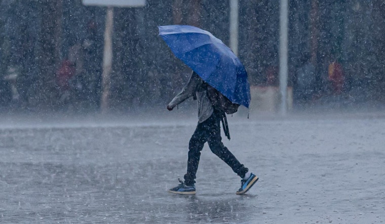
New Orleans stepped into a warm, soupy Thursday morning, with clouds hanging low, temperatures in the upper 70s, and humidity doing most of the heavy lifting. A few scattered showers could pop up before 10 a.m., but the main action is expected between 10 a.m. and noon, when a round of showers and thunderstorms with locally heavy downpours could slow the morning commute. The high should land near 81°F, with northwest winds around 5 to 10 mph and stronger gusts inside the heavier storms.
Timing And What To Expect
According to the National Weather Service New Orleans, showers and thunderstorms are most likely from late morning through midday, with a 70% chance of rain today and new rainfall amounts generally between a tenth and a quarter of an inch. A few storms could be on the strong to severe side and may produce heavier downpours capable of brief urban flooding and gusty winds. Lightning will be possible with any thunderstorm.
Commute And Local Impacts
Plan for a slower ride during the late-morning storm window, since heavy rain and poor visibility can quickly lead to ponding on roads, flooded low spots, and delays for buses and streetcars. If you have outdoor plans, it is a good day to move them inside or push them back. This update tweaks last week’s steamy New Orleans forecast, with minor shifts in timing and intensity.
Weekend Outlook
The unsettled pattern sticks around into the weekend, with a stronger round of rain expected from Friday night into Saturday that could bring widespread totals of 1 to 2 inches and locally higher amounts. According to the National Weather Service New Orleans, that Friday night system looks more like a heavy-rain producer than a major severe weather outbreak, though isolated strong storms and brief flooding are still on the table before a cooler, drier stretch settles in early next week.
How To Stay Ready
Keep an umbrella and a light extra layer handy in your car, build in some extra time for the commute, and never drive through standing water. The City of New Orleans emergency site, NOLA Ready, offers tips on dealing with urban flooding and local alerts. If you rely on public transit, sign up for NOLA Ready updates and keep an eye on RTA service changes.
This story will be updated if any watches or warnings are issued; otherwise, expect a wet start with conditions gradually improving later in the day. For the latest forecast details and any changing threats, check the National Weather Service and local alerts before heading out.


