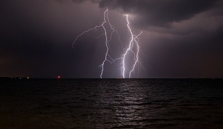
New Orleans woke up warm, cloudy and sticky, with temperatures parked near 70°F at the KNEW observation and the atmosphere already loading up for trouble. Scattered showers will build through the morning, with showers and thunderstorms becoming likely by late morning into the afternoon. The most intense cells could dump brief but heavy rain, leading to localized street flooding through early Saturday.
Today and Tonight
Highs will top out around 73°F, and the chance of rain is about 90% today as several rounds of showers and thunderstorms sweep across the area. New rainfall totals of three-quarters to one inch are possible today, with another 1–2 inches tonight in spots where storms repeatedly track over the same neighborhoods. That pattern raises a flash flood concern for parts of the region, especially the Florida Parishes and southwest Mississippi.
Northeast winds will run 5–15 mph this afternoon, then ramp up to around 15 mph with gusts near 30 mph late tonight. Boaters should expect rough going on the lakes and nearshore waters, and a Small Craft Advisory is in effect from this evening into Sunday morning, according to the National Weather Service.
Boaters, Drivers And The Commute
Count on a slow, soggy commute this afternoon and evening. Patchy ponding on low-lying streets and reduced visibility in the heaviest downpours are likely, so plan extra time and keep speeds down. If you were eyeing a run onto Lake Pontchartrain or the coastal waters, it is worth considering waiting until after the advisory lifts. On the roads, avoid driving through standing water and give yourself more stopping distance on slick pavement.
This wet finish to the workweek did not come out of nowhere; we flagged it in our April 29 outlook. For a refresher on how we got here, see our earlier forecast on how the week would sizzle first, then soak.
Looking Ahead
The front finally slides offshore Saturday night, opening the door to a drier, cooler air mass. Highs will be near 70°F on Saturday, with clouds giving way to brighter skies by Sunday and highs in the mid‑70s. Temperatures tick back up early next week, and only isolated storms are expected through midweek, making outdoor plans a lot easier to pull off after this stormy stretch wraps up.


.jpg)