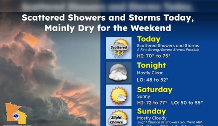
Minneapolis started Juneteenth on a calm and cool note Friday, June 19, 2026, waking up to mostly clear skies and temperatures near 55°F at Minneapolis–Saint Paul International Airport. Forecasters expect highs near 74°F, but showers and scattered thunderstorms are likely to bubble up this afternoon, with the potential for brief downpours, small hail, and gusty winds.
Afternoon Storms: Timing And Threats
There is a slight chance of showers around midday that grows into scattered thunderstorms in the mid-to-late afternoon, with the highest odds lining up roughly between 3 and 7 p.m. The National Weather Service notes a limited risk, level 1 out of 5, for storms that could produce marginally severe hail and damaging wind gusts, so anyone planning to be outside should have a quick shelter option in mind.
What This Means For Juneteenth Events And Commute
Juneteenth gatherings and outdoor festivals across the metro may see some weather interruptions this afternoon. The Minneapolis Park & Recreation Board lists park-based Juneteenth activities that could be affected if storms move through during peak event hours. Attendees should be ready for short-term delays from sudden downpours and consider backup indoor plans, especially for events set up in low-lying park lots where water can pool quickly.
Tonight And Weekend
Showers and storms are expected to taper off by mid-to-late evening, with skies clearing overnight and a low near 54°F. Saturday looks to rebound nicely with more sun, mild conditions, and highs near 76°F. Another system could bring renewed chances for showers and thunderstorms by Tuesday, so anyone lining up plans later in the week will want to keep an eye on updated forecasts.
If you will be outside today, keep your phone charged for weather alerts and secure lightweight patio furniture and tents before storms fire up. Move under sturdy cover at the first sound of thunder, since lightning can strike well ahead of the heavier rain.


