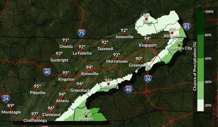
Tuesday, June 30, 2026, started with patchy fog and mist that quickly traded up for thick, sticky humidity across the Knoxville area. Morning readings sat in the mid-70s, and highs are expected to push into the mid-90s this afternoon, with heat-index values repeatedly topping 100°F and some valley spots possibly nudging up toward 105°F.
What To Expect Today
Skies should stay mostly sunny this afternoon with a high near 94°F and only light winds, which will not offer much relief from the steam-bath feel. According to the National Weather Service - Morristown, a Heat Advisory is in effect from 11 a.m. Tuesday through 9 p.m. Thursday for much of East Tennessee.
Afternoon Storm Risk
Isolated to scattered storms may fire up later today over higher terrain and the nearby foothills. A few of these cells could produce damaging downburst winds and small hail, while most valley and urban locations are expected to stay hot, dry, and uncomfortable.
How To Stay Safe
Heat precautions are the name of the game: stay hydrated, avoid strenuous outdoor work during the midday peak, and use air-conditioned spaces when you can. The National Weather Service advises, “Drink plenty of fluids, stay in an air-conditioned room, stay out of the sun, and check up on relatives and neighbors.” If someone shows signs of heat stroke, call 911.
Looking Ahead
The hot stretch looks locked in through the holiday weekend, with highs hanging near the mid-90s Wednesday through Thursday and very little cooling at night. We first flagged the rising heat on Monday; see our earlier coverage for background in this steam-bath wake-up.


