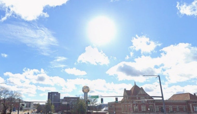
Wednesday, June 10, 2026, Knoxville woke up under patchy fog and mist, with the Knoxville Downtown Airport reporting about 68°F and near-calm winds early in the morning. The fog is expected to burn off by mid-morning, with highs near 88°F and heat-index values pushing into the mid-90s later today. There is also a slight chance of showers or a brief thunderstorm before 4 p.m.
Foggy Mornings, Sunny Afternoons
Low-lying fog is set to knock down visibility on valley roads through the morning commute, so drivers should allow extra time and take it slow on bridges and in shaded stretches where the haze tends to linger. By late morning, skies should turn partly sunny, with southwest winds around 5 to 10 mph and afternoon highs topping out near 88°F. This forecast comes from the National Weather Service.
Afternoon Heat And Spotty Storms
Heat and humidity will team up to make it feel hotter than the thermometer, with heat-index values potentially reaching the mid-90s this afternoon. That means it is a good idea to limit strenuous outdoor activity during the peak heat of the day. There is a slight chance of a brief, fast-moving thunderstorm this afternoon, and any stronger cell could drop a quick burst of heavy rain and kick up gusty winds. If you have outdoor plans, look for shady, water-accessible spots and keep an eye on radar in case something pops up.
Weekend Outlook And Changing Pattern
Temperatures climb as the week wraps up, with highs around 90°F on Thursday and Friday and a few hotter spots nudging near 91°F. In the warmest areas, heat-index values could crack the 100°F mark on Thursday. Showers and thunderstorms become more likely Friday afternoon and Friday night as a front edges closer, and that boundary may move through sometime between Friday and Saturday. It should bring at least brief relief from the heat, although forecast models keep an unsettled pattern hanging around into next week. Slow-moving storms could unleash localized heavy rain and isolated flash flooding, so anyone planning outdoor events will want a backup plan.
Local Resources
Knoxville officials have discussed opening cooling centers when temperatures reach around 90°F and expanding shelter and transit support during periods of extreme heat. Residents who depend on air-conditioned public spaces are encouraged to follow local announcements closely. For background on the council discussion, see reporting from WVLT, and check city and transit websites for the latest lists of cooling centers and updated hours.


