Minneapolis is starting the week on a mellow note, with clear skies, light winds and temperatures near 57°F at Minneapolis-Saint Paul International Airport. Expect a bright, dry Monday with highs around 80°F before a wetter pattern muscles in late Tuesday.
Timing And Impacts
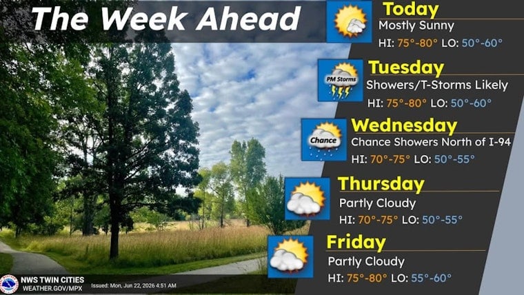
Showers are expected to ramp up on Tuesday, June 23, 2026, with the best chance for showers and thunderstorms from late morning into the afternoon and especially Tuesday night. According to the National Weather Service Twin Cities, the probability of precipitation Tuesday is high, and forecasters are watching for the potential of multiple rounds of showers and storms.
Rain Totals And Risks
Most spots should pick up a few tenths of an inch of rain, with Tuesday night totals commonly around a quarter to a half-inch. Locally higher amounts are possible where storms train or stall over the same areas. Some model runs hint at pockets of heavier rain, and a few storms could kick out small hail, though damaging straight-line winds appear less likely given the expected stable lower atmosphere. For a broader look at how this fits into the week, see this earlier midweek drenching setup.
Plan Ahead
Plan on rain gear for Tuesday and consider moving outdoor get-togethers indoors or to later in the week, since heavier downpours could slick up roads and turn lawn events into mud zones. Minneapolis-Saint Paul International Airport is operating normally today, but brief visibility reductions or delays are possible during Tuesday's heavier storms, so check with your airline if you have flights booked.


