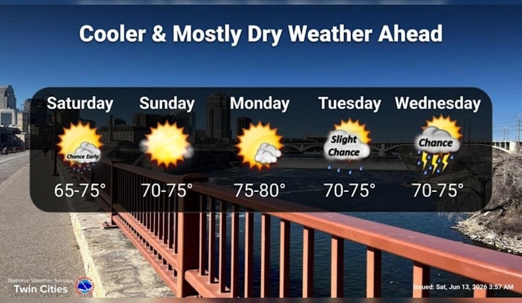
As of 5:35 a.m. CDT Saturday, Minneapolis was mostly clear and about 61°F with a light west-northwest breeze. Expect a sunny day with a high near 73°F, running a bit below normal for mid-June.
Afternoon Breezes Crank Up
According to the National Weather Service Twin Cities, winds will be west-northwest 5–15 mph this afternoon, becoming northwest 10–15 mph tonight with gusts as high as 25 mph. That will make conditions blustery along the riverfront and on exposed bike lanes, so secure patio furniture and loose yard items ahead of sunset if you do not want them migrating down the block.
Weekend Snapshot
The rest of the weekend looks dry and comfortable: highs in the low 70s both Saturday and Sunday, with overnight lows in the low to mid-50s. Humidity will be lower than earlier in the week, so outdoor plans this afternoon should feel pleasant rather than sticky.
Next Week Rain Chances Return
A more active pattern returns next week with a few rounds of showers and thunderstorms possible Monday night into Tuesday, and the best chance arriving Wednesday when showers and storms are likely. We first flagged this setup earlier this month, and forecasters now have the mid-week window as the highest-confidence period.
Enjoy the sun and mild temperatures today, but bring a light layer this evening if you will be out by the lakes, and check the forecast again before any mid-week outdoor events in case the timing of storms shifts.


