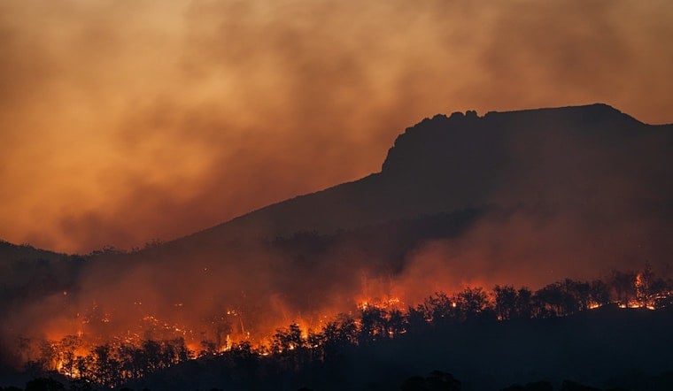
The wind is up, the air is bone-dry, and the Mojave Desert is officially on notice. A Red Flag Warning is in effect for the region, including Morongo Valley and Yucca Valley, from 5 p.m. Tuesday, June 23, 2026, through 11 a.m. Wednesday, June 24, 2026. Forecasters say hot, very dry air combined with gusty winds could let any new spark rip quickly through desert brush. Residents, campers and travelers are urged to treat open flames and smoking materials with extreme caution until the warning expires Wednesday morning.
According to The Sacramento Bee, the National Weather Service office in Las Vegas posted the advisory Tuesday morning, setting the critical window from 5 p.m. to 11 a.m. The Bee's CA Weather Bot notes that the warning specifically targets the Mojave Desert fire-weather zone that includes Morongo and Yucca valleys.
What a Red Flag Warning Means
A Red Flag Warning is weather-speak for prime wildfire conditions. Warm temperatures, very low humidity, and stronger winds are expected to combine to create a heightened fire risk, the National Weather Service explains. During these stretches, the agency recommends skipping any open burning, ensuring burn barrels are covered with weighted metal lids, and never leaving charcoal grills or campfires unattended.
Local Burn Rules and Enforcement
Local fire officials are even more blunt. Open burning is typically off the table during Red Flag and Fire Weather Watch conditions. San Bernardino County Fire states that all open fires must be extinguished when red-flag conditions are in place and that South Desert communities, including the Town of Yucca Valley, are listed as "Burning NOT Allowed."
Conditions to Watch This Week
The forecast discussion from the National Weather Service office in Las Vegas calls for hot, breezy weather with afternoon relative humidity values hovering around 10 percent and poor overnight recovery. Forecasters add that isolated to scattered thunderstorms along and southeast of the I-15 corridor could throw dry lightning and erratic winds into the mix. The National Weather Service also highlights gusts around 35 to 40 mph in some spots and warns that the lack of nighttime moisture will leave brush and other fuels unusually ready to ignite.
Anyone living, working or recreating in the affected zone is urged to monitor local updates and delay any outdoor burning until the weather calms down. San Bernardino County Fire and local media will share any extensions or changes to the advisory. For the latest official forecasts and map-based fire-weather zone alerts, check your local National Weather Service office and follow directions from fire authorities.


