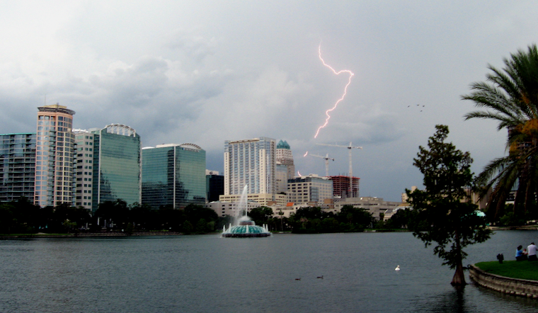
Orlando rolled into Monday, June 1, 2026 with sticky, clear skies and that classic Central Florida wall of humidity. Temperatures sit near 79°F with dew points in the low 70s, and highs are headed for the upper 80s this afternoon. That kind of muggy start means any afternoon downpours will feel extra heavy and are likely to come with plenty of lightning.
Afternoon Storms Possible
A chance of showers and thunderstorms returns after 11 a.m. Monday, June 1, 2026, with most of the action expected near the Atlantic coast while inland spots see scattered cells. West winds of 5–15 mph with gusts up to 25 mph may keep the sea breeze pinned close to the shoreline and concentrate storms along coastal communities, so it is worth keeping an eye on radar during the afternoon commute.
Tuesday Brings Higher Storm Risk
Tuesday, June 2, 2026 is shaping up to be the wetter day across central Florida. Showers and thunderstorms are likely, and forecasters flag a marginal risk for strong to severe storms capable of producing damaging wind gusts and heavy downpours. Forecasters at NWS Melbourne note that the greatest coverage and the higher severe risk should arrive during Tuesday afternoon and evening.
Coastal And Marine Concerns
All east‑central Florida beaches carry a moderate rip‑current risk this week, so swimmers should check posted flags and stick close to lifeguards before heading into the surf. Offshore swells and onshore winds will make some beach breaks choppy, a setup that shows up clearly on the NOAA rip current map.
Plan Ahead
Boaters should be ready for seas building Tuesday night into Wednesday, with a chance of Small Craft Advisories and nearshore seas peaking around 5–7 ft. A marginal risk of strong, gusty storms Tuesday evening could make conditions even rougher. Check the latest outlooks from NWS Melbourne before heading out, keep a quick shelter plan for any outdoor events, and avoid swimming outside lifeguarded areas while the rip‑current risk sticks around.


