

























































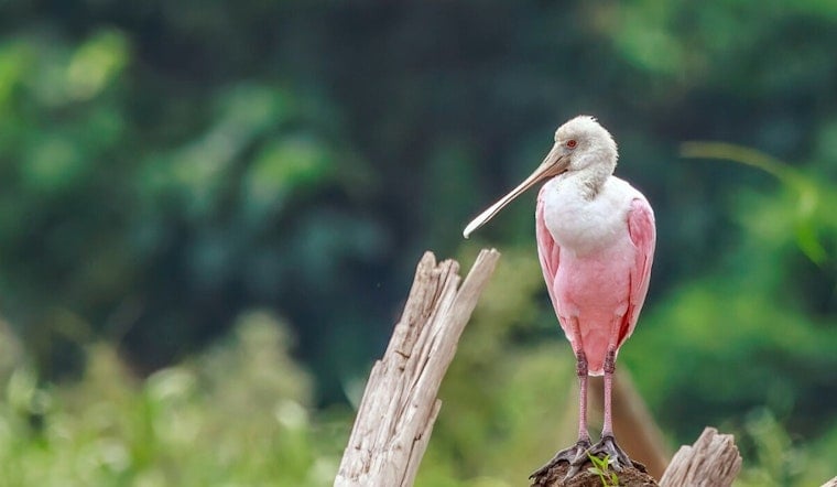
As seas creep inland along South Florida’s coast, roseate spoonbills are quietly pulling off a real estate shakeup in the Everglades. This breeding season, researchers logged a noticeable jump in inland colonies, even as long-famous nesting spots in Florida Bay have thinned out. Field teams tallied 244 nests, the first season to crack 200 since 2020, a sign the birds are testing fresh territory. The reshuffle tracks with both seasonal water management swings and the longer drumbeat of sea level rise that is changing the shallow puddles spoonbills rely on to feed their chicks.
Field counts and what they tell us
Audubon field crews and Everglades biologists kayaked and bushwhacked through mangroves to scope out nesting colonies and documented 244 nesting attempts this year, evidence that spoonbills are embracing new inland sites. Wading-bird research specialist Shauna Sayers described the chicks as “pink, fuzzy balls” that make a “cute clacking noise,” a lighthearted take on a species that has been closely studied in South Florida for decades. The latest tally is a steep drop from the roughly 1,250 nests recorded in Florida Bay in 1979, a comparison that drives home how far nesting has shifted over time. As reported by the Miami Herald, the current count, while modest next to historical highs, still represents a rebound from several recent lean years.
Sea-level rise is changing foraging habitat
Scientists say water depth sits at the heart of the problem. Spoonbills feed most efficiently in puddles about five inches deep, and long-term monitoring shows Everglades water levels have climbed close to that amount since 2000. According to Audubon, that seemingly small change means 80 to 90 percent of Florida Bay’s historic foraging zone may no longer work for spoonbills during nesting season. Birds are pushed to search out inland puddles or higher mangrove keys instead. With fewer shallow, concentrated feeding flats, chicks have a harder time getting enough food and the map of where colonies can thrive is being redrawn.
Bands and trackers reveal a northward push
To follow that reshuffling, scientists have banded or fitted GPS trackers on roughly 3,000 spoonbills. Those markers, along with public sightings, show the species easing beyond its traditional Florida Bay stronghold. The data reveal growing colonies in Tampa Bay, new nesting records in Savannah and parts of North Carolina, and occasional wanderers turning up as far north as Maryland and Minnesota. The banding effort and these far-flung reports were detailed by the Miami Herald, which notes that both climate shifts and local water management choices are steering the birds’ movements.
What this means for restoration efforts
For Everglades restoration managers, the spoonbills’ search for new feeding grounds is not just a bird story, it is a moving target. The timing and volume of freshwater releases now play an outsized role in when and where the right shallow flats appear. The South Florida Water Management District’s 2026 environmental report lays out how altered flows combined with rising tides can squeeze the already narrow window of suitable feeding conditions for wading birds. Per the 2026 South Florida Environmental Report, holding on to a mix of tidal flats, mangroves and marshes will be crucial if spoonbills and other species are going to have enough room to adjust.
Why spoonbills matter — and where to report sightings
Roseate spoonbills function as a kind of feathery early-warning system for coastal health. Where they can successfully nest and feed offers managers a real-time signal of how the Everglades and Florida Bay are coping with sea level rise. Birders, anglers and boaters who spot a banded spoonbill can plug directly into the science by reporting what they see. Audubon collects those sightings through an online reporting form. Each band report and GPS ping feeds into decisions about habitat protection and water management that will shape the region’s future.





_young_adult_Rio_Napo.jpg)