

























































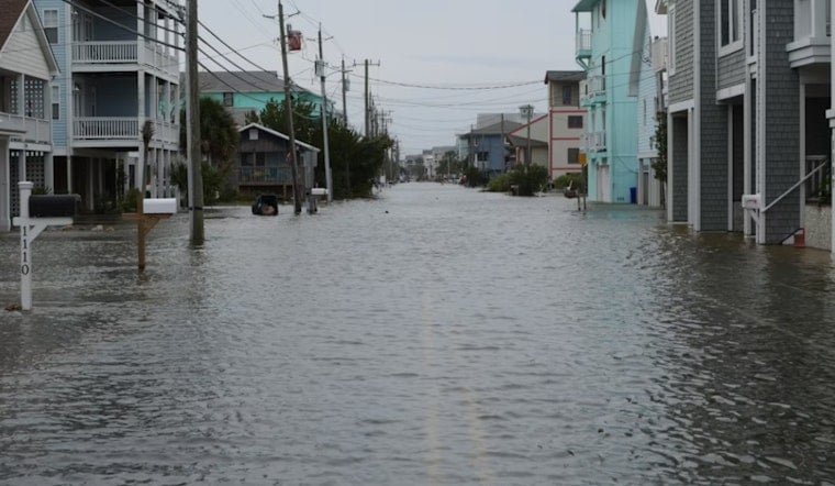
On Friday, July 10, 2026, a First Alert Weather Day was declared as rounds of storms and flash flooding hit counties south and southwest of St. Louis. Heavy overnight rain left low-water crossings and neighborhood streets under water, and forecasters warned that more storms could develop from the late afternoon into the overnight hours.
What forecasters saw
KMOV's First Alert 4 reported that meteorologists were tracking a risk of damaging winds and additional heavy rainfall across the region, with scattered storms expected to fire up from about 3 p.m. into the early overnight period. As noted by First Alert 4, the First Alert Weather Day designation was put in place to keep close watch on the threat to the metro area and nearby counties.
Flood watches and warnings
The National Weather Service in St. Louis issued a Flood Watch and multiple Flash Flood Warnings for parts of southeast Missouri, explaining that radar estimates showed several inches of rain had already fallen across Phelps, Crawford, Reynolds and Iron counties. According to the National Weather Service, some warning messages cited between 4 and 8 inches of rain and cautioned that low-water crossings could be impassable.
Official safety message
The National Weather Service urged residents to stay off flooded roadways and repeated the agency's life-saving slogan: "Turn around, don't drown when encountering flooded roads." The agency emphasized that repeated heavy rain could trigger life-threatening flash flooding of creeks, streams and urban areas within the watch and warning zones and advised people to follow local emergency instructions.
State response and context
State agencies are coordinating assistance for communities affected by the heavy rain, and the Missouri Department of Natural Resources says its Southeast Regional Office is prepared to help with debris management and water and wastewater facility support. For details on regional resources and contact numbers, see the Missouri Department of Natural Resources.
How to stay safe
Before heading out, residents are advised to move vehicles to higher ground, keep phones charged and avoid driving through standing water, since low-water crossings and underpasses can quickly become dangerous. For live radar and local alerts, people can check the First Alert 4 app or their preferred weather feed and follow directions from local officials; see First Alert 4 for station updates.
Forecasters expect rain chances to ease by the weekend, with Sunday projected to be drier and closer to normal July humidity. Residents are advised to monitor local weather information and official National Weather Service products for any late changes to the forecast.




