

























































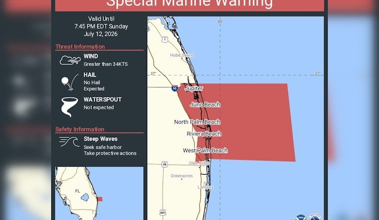
Boaters off the Palm Beach County coast got a jolt Sunday evening when the National Weather Service in Miami issued a Special Marine Warning for the stretch of water from Jupiter Inlet to Deerfield Beach, out roughly 20 nautical miles offshore. The quick-hitting alert, in effect through 7:45 p.m. EDT, flags the kind of sudden strong gusts and steep, choppy waves that can flip or flood small boats in a hurry. Officials urged mariners, charter captains and weekend riders alike to head for safe harbor without wasting time.
What the NWS Posted
According to NWS Miami, the Special Marine Warning targets coastal waters from Jupiter Inlet to Deerfield Beach out 20 nautical miles and is set to expire at 7:45 p.m. EDT, assuming conditions improve. Forecasters highlighted wind gusts of 34 knots or higher and steep waves as the main dangers tied to this alert. They also noted that hail and waterspouts were not expected with this particular round of storms. Mariners were told to “seek safe harbor” and take protective action as the rough weather moves through the warning zone.
Hazards and Safety Steps
Short, punchy squalls along Florida’s sea-breeze boundary can whip up strong gusts and very steep seas in minutes, creating an outsized threat for small vessels and personal watercraft. The U.S. Coast Guard advises boaters to monitor VHF channel 16, file a float plan with someone on shore, wear life jackets and move into sheltered water when the sky starts looking mean. Harbor masters and port officials may also restrict departures when Special Marine Warnings are in play. For general safety guidance, see the U.S. Coast Guard.
Where the Warning Hits
The Miami forecast office bulletin calls out a lineup of coastal communities within the zone, including Hobe Sound, Jupiter, Juno Beach, North Palm Beach, Riviera Beach, West Palm Beach, Glen Ridge, Greenacres and Lantana. The Special Marine Warning covers the nearshore band out to about 20 nautical miles and can be pushed farther offshore if storms track seaward, according to the agency’s marine products. Mariners and beach operations are urged to keep an eye on updates from the National Weather Service in Miami as conditions evolve.
Why These Pop-Up Warnings Are So Common
Summer sea-breeze collisions over warm Atlantic water routinely ignite fast-developing thunderstorms along South Florida’s coast, and those brief but intense cells are classic triggers for Special Marine Warnings. Because the worst of the wind and waves can develop with little notice, forecasters stress checking official marine forecasts before heading out and staying within quick striking distance of shelter when operating nearshore.



