

























































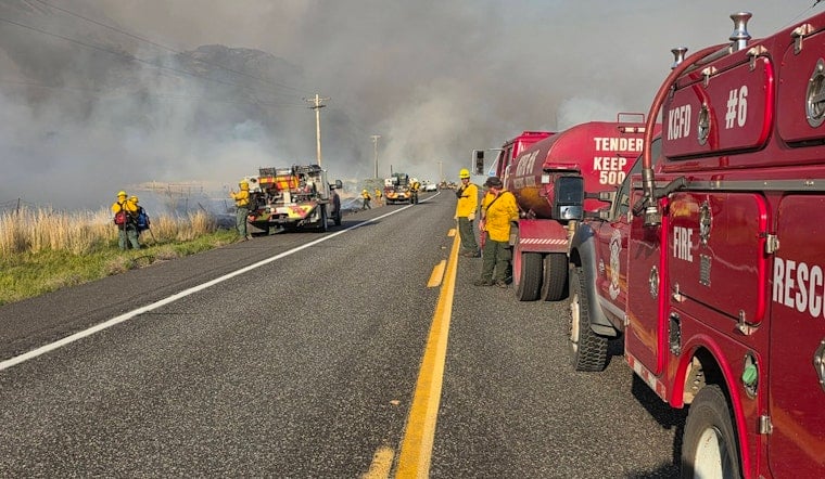
A fast-moving wildfire has shut down an 11-mile stretch of Highway 14 east of Dallesport, Washington, with no detour available, and prompted evacuation orders that escalated overnight for the small Columbia River community of Wishram Heights. The blaze, dubbed the Avery Fire, forced the closure just east of Dallesport, according to the Washington State Department of Transportation.
The wildfire forced the closure of Highway 14 near Dallesport, according to KATU, which reported the highway was shut between milepost 84 at Dalles Mountain Road and milepost 89 at Avery Road as of Wednesday evening. By Thursday, the closure had grown substantially: KGW-TV reported that WSDOT had expanded the shutdown in both directions to span a full 11 miles, from Avery Road at milepost 89 to the SR 14/US 97 interchange at milepost 100 near Maryhill. WSDOT said there is no available detour and no estimate for when the highway will reopen.
Evacuation Levels Climb Overnight
Klickitat County Emergency Management reported that Level 3, Level 2, and Level 1 evacuation orders are in effect across the fire area, according to the agency's Facebook page cited by KATU. The situation intensified Wednesday night, when county officials raised Wishram Heights to Level 3, meaning residents must go now, while Wishram itself moved to Level 2, or get set to leave, according to a report carried by EIN News.
Officials instructed anyone evacuating to travel east on Highway 14, warning that heading west was dangerous because of fire, heavy smoke, and emergency responders working the roadway, per the same EIN News report. Wishram is an unincorporated community along the Columbia River just east of Dallesport, and Census Reporter data shows it had 411 residents and a median age of 49.4 as of 2024. The town was established as a major rail hub and named for the native Wishram tribe.
Klickitat County officials also announced Wednesday that a temporary emergency shelter was being set up for residents displaced by the fire, though facility details had not yet been finalized or broadcast, the same EIN News account noted. An interactive map showing current evacuation zones has been made available to residents tracking the fire's path, KATU reported.
A Historic Fire Season Sets the Stage
The Avery Fire erupts amid what the Washington Department of Natural Resources has called the state's worst wildfire season since tracking began in 2016. By mid-August, more than 300,000 acres had burned across 671 wildfires statewide, according to MyNorthwest.com, with roughly 70 percent of those fires occurring east of the Cascades. Governor Bob Ferguson had already issued a statewide wildfire emergency declaration and outdoor burn ban on August 1, citing prolonged drought, record heat, and high winds.
That declaration followed a broader mobilization effort. Washington State Patrol Chief John Batiste authorized a statewide wildland fire mobilization plan on August 21, prepositioning firefighting crews and equipment across Klickitat, Yakima, and Kittitas counties ahead of anticipated fire activity, a step Hoodline detailed in its coverage of the nearby Colwash Fire. That same week brought Level 3 evacuations near Salmon La Sac in Kittitas County from the Goat Fire, and a Southwest Washington blaze near Battle Ground that threatened hundreds of homes before being contained.
Southern Klickitat County's dry, wind-swept terrain has produced destructive fires before. In July 2023, the Newell Road Fire burned 60,551 acres near Roosevelt, becoming the largest wildfire in the United States at the time and threatening homes, farmland, and green-energy infrastructure, according to Wikipedia's account of the blaze.
A Vital Corridor Cut Off
The closure carries outsized consequences because Highway 14 is the only major route on the Washington side of the Columbia River Gorge across from Oregon's Interstate 84. The 180.7-mile highway carries an estimated 3,600 vehicles per day near Dallesport and is part of the National Highway System and the Lewis and Clark Trail Scenic Byway, according to Federal Highway Administration data.
Complicating matters further, WSDOT had already scheduled single-lane closures at the US 97 and SR 14 interchange near Maryhill starting August 24 for safety construction work, creating a bottleneck near the fire's eastern closure point even before the Avery Fire broke out. With no detour available and no reopening timeline, drivers and evacuees alike face an uncertain wait as crews work to contain the blaze.





