

























































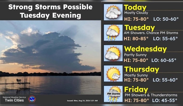
Minneapolis wakes Monday under cloudy skies near 61 degrees, but the day should turn warmer and brighter. The afternoon high is expected to reach 82 degrees, with only a slim chance of rain.
Warm Monday Winds Pick Up
Skies will trend partly sunny to mostly sunny through the afternoon as southerly winds run from 0 to 10 mph. A few gusts could approach 20 mph, while the chance of precipitation remains around 3%, according to the National Weather Service.
Tuesday Brings Storm Chances
Monday night stays partly cloudy, with a slight chance of showers or thunderstorms after about 2 a.m. Tuesday. Minneapolis could reach 85 degrees Tuesday, but the National Weather Service expects a broader chance of storms during the day.
The strongest storms are more likely east of Interstate 35, though a few storms could still affect the Twin Cities. Damaging winds and large hail are the main concerns if storms organize Tuesday afternoon or evening, and no watches, warnings or advisories are currently posted.
Sunshine Returns Wednesday Through Friday
Cooler, drier air arrives Wednesday behind the front, bringing sunny skies and a high near 80 with northwest winds of 10 to 15 mph. Thursday and Friday look similarly pleasant, with highs near 81 and 82 and overnight lows dropping into the lower 60s.
Storm Chances Return Next Weekend
The quiet stretch may not last through the weekend. Showers and thunderstorms have a 50% chance Friday night and Saturday, followed by a 40% chance of rain showers Sunday, although Sunday could still turn mostly sunny with a high near 83.
The latest forecast marks a more defined Tuesday storm concern than the earlier outlook for the week. Earlier Hoodline coverage also tracked storm chances returning after a warm, quiet start, but the newest update points to the best severe-weather potential Tuesday afternoon and evening.





