

























































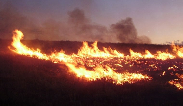
A wildfire ignited Monday afternoon along a ridge south of the Cache la Poudre River in the 30000 block of Colorado Highway 14, prompting mandatory evacuation orders for residents near Salt Cabin and Forest Road 259 north of Crown Point Road in the Bellvue area. The fire, initially referred to as the South Hwy 14 Fire, was soon given an official name: the Dadd Gulch Fire.
Fast-Moving Response in Rugged Terrain
According to North Forty News, the fire was estimated at approximately 0.25 acres by the U.S. Forest Service as of Monday afternoon, while a Type 1 helicopter was on scene. The report did not specify the helicopter's role.
The mandatory evacuation zone stretched from Forest Road 139A to the west, Pingree Park Road to the east, and Forest Road 139 to the south, according to the Larimer County Sheriff's Office. Residents within that zone were subject to the mandatory evacuation order.
Evacuations Downgraded, Then Lifted
By 4:28 p.m. MDT, NOCO Alert downgraded the mandatory order for the Salt Cabin and Forest Road 259 area to voluntary status, the same North Forty News report noted, with all evacuations fully lifted later that afternoon. Under the voluntary designation, residents were still advised to gather essential items and remain ready to leave if conditions changed, per the Larimer County Sheriff's Office update posted to Facebook. The sheriff's office also pointed residents to LCEVAC for text updates at 888777, and to NOCOAlert.org for a map of the evacuation area, while LETA remained involved in emergency notifications.
Those alerts flow through the Larimer Emergency Telephone Authority's NOCO Alert system, which has partnered with ReachWell to push real-time evacuation notices to mobile devices in more than 100 languages, according to the Town of Windsor. LETA 911 coordinates emergency communications across 25 local government and safety agencies in the county.
A Landscape Still Shaped by Cameron Peak
The Dadd Gulch and Salt Cabin corridors sit adjacent to the 2020 Cameron Peak Fire burn scar, where crews built dozer containment lines along the Dadd Gulch ridgeline during what became Colorado's largest wildfire on record at 208,913 acres, according to Oil City News. The area's fire history is part of its documented wildfire context.
It's also why federal land managers have targeted this stretch of forest for fuels reduction. The Roosevelt National Forest's Canyon Lakes Ranger District planned the 4,572-acre Salt Cabin Prescribed Burn project two miles southeast of Rustic this past February, according to the USDA Forest Service. The project was designed to sit strategically between the Black Diamond Forest Health Resiliency Project and the 2020 Cameron Peak Fire burn scar. The Dadd Gulch Trail is also described in local trail information.
Part of a Busy Late-Summer Fire Season
Monday's fire followed a cluster of late-summer wildfire reports across Larimer County, including the Moose Mountain Fire near Pinewood Springs on August 28, according to CBS Colorado. The Dadd Gulch report identified the Forest Service and NOCO Alert in connection with the fire and evacuation information.
The county coordinated its response Monday.
The heightened response posture also traces back to the July 2024 Alexander Mountain Fire, which burned 9,668 acres in Larimer County. The supplied reports do not detail prosecutorial action in that case. No injury or structure-loss details were provided in the Dadd Gulch Fire report.





