

























































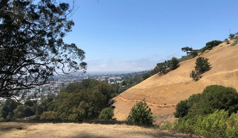
A very slow-moving grass fire broke out just before noon Tuesday on the steep slopes of Panoramic Hill above the UC Berkeley campus, burning two to three acres and reaching at least one hillside home before more than 60 firefighters converged to beat it back. Berkeley firefighters said one structure was threatened and reported no immediate injuries, though the blaze forced crews to warn residents to steer clear of the area for much of the afternoon.
The fire ignited around 11:36 a.m. near Panoramic Way at the Stonewall-Panoramic Trail, according to SFGATE, which dubbed it the Panoramic Fire as it crept slowly across the hillside. Berkeley Fire Department pegged the location as the 800 block of Panoramic Way and the ignition time at 11:40 a.m., according to CBS News. Flames reached a residential structure at 1001 Panoramic Way — the address of the hilltop Skyfall Estate property — with aerial coverage showing crews surrounding and working atop the building, per KQED.
Dozens of Firefighters Converge on a Single Narrow Road
More than 60 firefighters from Berkeley, Oakland, Alameda County Fire, Cal Fire and the East Bay Regional Park District responded, the station's report notes. Berkeley firefighters, Oakland firefighters and Cal Fire crews all remained on scene into Tuesday afternoon, per CBS News, which also reported that no evacuations were ordered even as officials urged people to avoid the area near the fire. UC Berkeley officials confirmed the fire was burning above campus but did not threaten university property or disrupt operations, according to Times Now.
The response underscores why even a modest grass fire on this hillside draws such a large mutual-aid deployment. Panoramic Hill sits in the city's Fire Zone 3 — Berkeley's highest wildland-urban interface risk designation, covering roughly 277 parcels, 261 buildings and more than 2,500 residents, according to the City of Berkeley's Local Hazard Mitigation Plan. Hoodline previously reported on neighbors' fire fears tied to that same classification.
One Road In, One Road Out
A City of Berkeley Evacuation Time Study published in July 2025 found that the neighborhood depends on a single winding road — Panoramic Way itself — for all access, with estimated evacuation times ranging from 45 minutes to 1 hour 45 minutes. Because Panoramic Way is the neighborhood's only way in or out and runs along the Oakland-Berkeley municipal boundary, any localized emergency can quickly become a traffic bottleneck for first responders and the roughly 1,000 residents of Panoramic Hill alike.
The vulnerability isn't new. Berkeley's EMBER program includes defensible-space rules and inspections. Local advocacy groups have criticized the rules.
A Hillside With a History of Fire
The East Bay hills carry the memory of the deadly 1991 Oakland Hills firestorm. The 1923 Berkeley Fire is another part of the area's fire history.
Tuesday's fire was far smaller in scale, but it arrived on a road that has already drawn emergency crews once this month. The Berkeley Scanner reported that officers and medics responded to the 400 block of Panoramic Way on October 2 after a double shooting along the Oakland-Berkeley border left two people dead — a case Hoodline covered in a report on the fatal shooting. Taken together, the back-to-back incidents highlight how often this single winding stretch of hillside road finds itself at the center of Berkeley's most serious emergencies.




