

























































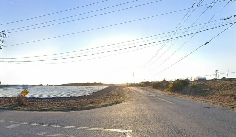
A new half-mile trail connecting Pajaro Valley High School to Watsonville Slough Farm is officially open, giving Watsonville walkers and cyclists their first taste of a project more than a decade in the making. The path begins at the corner of Lee Road and Harkins Slough Road, and about 45 people turned out for a ribbon-cutting ceremony last Saturday to mark the milestone.
The half-mile opening marks the first completed stretch of a project identified in Watsonville City Council's 2012 Trails and Bicycles Master Plan, according to the Pajaronian. A December 2025 City Council agenda report lists the phase-one construction contract with Monterey Peninsula Engineering at $1,683,523, plus a 10 percent contingency of $168,352, for a total project cost of $1,851,875.
That same agenda report, filed in December 2025, describes the route running from the Pajaro Valley High School driveway on Harkins Slough Road, 500 feet west to Lee Road, then 2,000 feet south to connect with Watsonville Slough Farm. Santa Cruz County adopted a mitigated negative declaration for the project back in March 2021, clearing the environmental review hurdle years before construction began.
Funding Sources Still Murky on Exact Prop 68 Figure
The city's December 2025 agenda report lists the project as fully funded by $1 million in federal funding secured through Congressman Jimmy Panetta, $400,000 from Proposition 68 and $451,875 from Measure D. The Pajaronian, however, reports that Land Trust Santa Cruz County contributed $770,000 in Proposition 68 funding. The available records do not explain whether the figures cover different funding scopes or phases.
Proposition 68 itself traces back to a 2018 statewide general obligation bond measure that set aside $4 billion for parks, recreation, natural resource conservation and water infrastructure, with a focus on underserved areas, per the same agenda report. The California State Coastal Conservancy also chipped in funding back in 2018 to help the city advance preliminary design and permitting for phase one, and Land Trust Santa Cruz County began coordinating with the city in 2019 to align the project with its own Community Harvest Trails initiative.
Wetlands Watch Planted the Shrubs, Shaped the Vision
Watsonville Wetlands Watch, a nonprofit that works to preserve and restore natural wetland habitats in the Pajaro Valley, helped the city with permitting and planning and planted native shrubs along the trail to attract beneficial insects. The Pajaronian reported that executive director Jonathan Pilch described the project as part of the organization's nearly 20 years of work to care for the trail system and expand the network.
Pilch told the Pajaronian that the half-mile segment is an early step toward linking the city's existing eight or nine miles of trails to a regional network planned to reach 33 miles.
Phase Two Brings a Bridge Over Struve Slough
Phase two, still in the design stage, would extend the trail another 3,300 feet and add an 800-foot pedestrian and bicycle bridge over Struve Slough. That bridge is planned to feature artwork created with community participation, though construction funding for the phase still needs to be secured, the Pajaronian reports.
Looking further out, phase three is envisioned to link the trail with additional city streets, the Watsonville Slough Trails, W. Beach Street and the future Coastal Rail Trail. The City Council's December 2025 agenda report describes the overall Lee Road Trail network extending three miles and tying into routes including the Lower Watsonville Slough Trail, the Manabe-Ow Trail and the five-mile Watsonville Slough Farm trail. A September 2021 fact sheet from the Santa Cruz County Regional Transportation Commission separately identified the Lee Road-to-Walker Street stretch as Segment 18 of the Coastal Rail Trail, a planned 1.2-mile piece of the larger 32-mile Coastal Rail Trail spine within the 50-mile Monterey Bay Sanctuary Scenic Trail Network.
Slough Farm Set to Add Five More Miles
The trail's southern end connects to the northeast corner of the 500-acre Watsonville Slough Farm. Mark Bibbo, a senior conservation project manager at the Land Trust, told the Pajaronian that public access in Santa Cruz County is concentrated in the north county. The property is expected to add five miles of trails, along with picnic shelters, gathering areas, community gardens, restrooms and a parking lot.
Slough Farm Access Has Its Own Planning Track
A February 2020 staff recommendation from the California State Coastal Conservancy proposed a $300,000 grant to the Land Trust for planning, design, environmental review and permit applications for five miles of trails and a staging area at Watsonville Slough Farm. That recommendation documents a planning step for the farm's public access, separate from construction of the Lee Road Trail's first half-mile; it does not specify a farm opening date.
Bibbo told the Pajaronian the Land Trust was close to breaking ground on the property and expected an initial ribbon-cutting the following fall. Janet Kreitzer, a Watsonville Wetlands Watch volunteer, said the project would benefit the community and students while restoring wetlands.





