

























































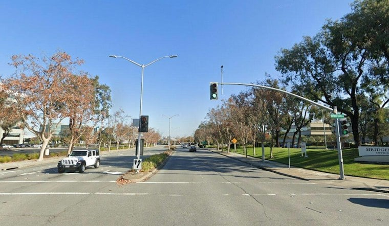
San Mateo is moving ahead with a plan to install separated bike lanes along Mariners Island Boulevard, a corridor city engineers found to be high-stress for cyclists along 99.7% of its length. The roughly $26.48 million project would add Class 4 separated bike lanes and upgrade a stretch of the Seal Slough Trail, part of a broader push by the city to improve safety on its busiest arterial streets.
The proposed lanes would stretch 1.39 miles along Mariners Island Boulevard, running from East Third Avenue and Tidelands Park to the city limit at State Route 92, according to San Mateo Daily Journal reporter Cecilia Schutz. The plan also calls for upgrading 0.35 mile of the off-road Class 1 shared path on the Seal Slough Trail between East Third Avenue and Anchor Road. Once built, the bike route would connect to the Bay Trail at its north end and to the Foster City Levee Pedway via Fashion Island Boulevard.
A Corridor Flagged as High-Stress for Cyclists
City engineering survey data found that 99.7% of the Mariners Island Boulevard corridor is considered high-stress for cycling, the newspaper's reporting shows. The same survey found the road ranked third-highest in traffic volume among 123 corridors studied citywide, trailing only Hillsdale Boulevard and East Third Avenue. Measured speeds on the stretch from East Third Avenue to Armada Way have reached up to 8 mph above the posted 35 mph limit, per the city's engineering survey.
Commissioner Kimi Narita told the paper she has seen people speed along the corridor at upwards of 50 mph. The National Association of City Transportation Officials sets 26 mph as the threshold speed above which protected bike lanes are recommended, the report notes.
What the Crash Data Shows
Ten collisions occurred along the corridor between 2021 and 2025, injuring 16 people with no fatal or severe injuries recorded, according to the same crash data cited in the Daily Journal's report. Eight of those crashes happened within 400 feet of the Fashion Island Boulevard intersection, and six occurred after dark. Just one of the crashes involved a cyclist, and none involved pedestrians.
Assistant Transportation Planner Ella Phillips said the lower crash numbers may reflect low exposure, since people may avoid biking on Mariners Island Boulevard without a designated lane in place, the Daily Journal reported. The pattern echoes what the city has tracked elsewhere: citywide, San Mateo logged 129 combined pedestrian and cyclist collisions between 2024 and 2025, according to San Mateo Daily Journal.
Funding Still Pending
San Mateo submitted the Mariners Island project for SamTrans review and is targeting a grant through the Regional Measure 3 Safe Routes to Transit and Bay Trail Program, requesting $26.21 million through the grant with a local match estimated at roughly $270,000. Grant funds have not yet been awarded, per the reporting. The program's Cycle 2 guidelines were adopted under MTC Resolution No. 4768, which covers Regional Measure 3 Project 4.
City staff plan to cross-check the road designs with NACTO standards and coordinate with Foster City to co-design East Third Avenue. San Mateo also intends to keep working with the transit agency on stop locations, boarding areas and how separated bike lanes will interact with bus lines along the route.
Green Infrastructure Requirements
The project requires green infrastructure that uses natural systems for water management to help mitigate extreme weather. Matt Fabry said the green infrastructure component would target stormwater treatment, which requires certain design standards but would not prevent trees or other foliage from being included. Vice Chair Jean-Paul Renaud said cities should pair people-focused retrofits with more green infrastructure.
The Mariners Island plan arrives as San Mateo juggles other contentious corridor projects. A separate effort along 19th Avenue/Fashion Island Boulevard, which the city has also flagged as a high priority for pedestrian, cycling and congestion improvements between Pacific and Mariners Island boulevards, is close to finishing its final design. That corridor logged about 200 collisions between 2019 and 2024, six involving pedestrians or cyclists, and its single lane in each direction makes it one of the few entrances into Foster City, contributing to heavy peak-commute congestion.
Not every bike lane proposal in San Mateo has sailed through unopposed. Proposed bike lanes along 19th Avenue and Fashion Island Boulevard have been described as part of a growing number of projects expanding rifts between some neighborhood residents and bike and transit advocates. As of June 2026, the city had completed about 22% of its high- and medium-high-priority bike improvements, though most of its remaining top projects could require removing parking or a vehicle travel lane — a tension that led the city to reverse course last year on a planned lane removal on South Delaware Street.
Statewide, the stakes of the debate are reflected in broader safety trends. California bicycle fatalities rose from 2016 to 2018, declined through 2021, then spiked sharply in 2022 before trending downward again, according to the California Active Transportation Safety Information Pages. Pedestrian fatalities followed a similar arc, climbing from 2016 to 2022 before easing off in subsequent years.





