

























































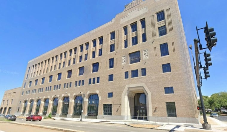
Downtown St. Louis is playing host this week to a gathering that looks nothing like the defense-focused geospatial conferences the city has grown used to. SatSummit runs Wednesday and Thursday at The Post Building, pulling together satellite operators, humanitarian groups, journalists and researchers to wrestle with a question that has grown more urgent all year: who actually gets to see satellite imagery, and who gets locked out.
A Different Kind of Geospatial Gathering
The two-day event is scheduled for November 18–19 at The Post Building, according to SatSummit, and draws people from the satellite, geospatial, research, government, humanitarian and development worlds. That mix stands apart from recent St. Louis geospatial events like September's Geo-Resolution conference, which Saint Louis University and the National Geospatial-Intelligence Agency co-hosted at SLU's Busch Student Center with an emphasis on national security, describing geospatial mastery as a national imperative, per Saint Louis University. SatSummit's published agenda instead poses a pointed question to attendees: should the industry be restricting satellite imagery as much as it currently does, and what does that holdback cost transparency and humanitarian aid efforts, the organization's agenda states.
Imagery access has faced real restrictions this year in Iran and the Gulf, while satellite imagery has also been used in coverage of Gaza and Ukraine. The The New York Times has covered satellite-image restrictions in the region. Middle East Eye reported that Planet Labs lifted some restrictions, particularly over Iran, on July 1, and that journalists and analysts covering the region increasingly turned to European and Chinese providers to fill the gap left by U.S. restrictions.
Humanitarian Groups Push for Public-Interest Access
Among the groups represented is Common Space, a nonprofit that describes itself as developing a community-governed satellite mission designed to prioritize humanitarian, environmental and public-interest uses of Earth-observation data, per Common Space. The organization argues that humanitarian groups, civil society organizations, researchers and local communities often lack the access, resources or influence needed to obtain timely imagery when it matters most, the same source notes.
Jen Marcus, Taylor Geospatial's vice president of strategic innovation programs, told the magazine that satellites can serve humanitarian groups and the public good, not just commercial or defense customers, and said cheaper launch and data-management technology has opened the sector to more commercial activity than before.
Food Security Takes Center Stage
Running alongside SatSummit is a forum tied to Taylor Geospatial's Geospatial Innovation for Food Security Challenge, which has selected three project awardees to build tools for humanitarian agencies, governments and agricultural specialists, according to Taylor Geospatial. Those initiatives are moving from proof-of-concept work toward full operational deployment over an 18-month period, with each team eligible for up to $550,000 in funding, the organization's announcement states. One of the awardees is the United Nations World Food Programme, which is partnering with the REACH Initiative to develop Afghanistan's PULSE platform, a tool meant to track hazards affecting food access and supply routes, per the same Taylor Geospatial release.
Rachel Opitz is Taylor Geospatial's Geospatial Innovation for Food Security Challenge program manager.
SatSummit Comes to St. Louis
The summit brings satellite operators, humanitarian groups, journalists and researchers to St. Louis to discuss who can access satellite imagery.
SatSummit brings participants together to discuss access to satellite imagery and its public-interest uses.





