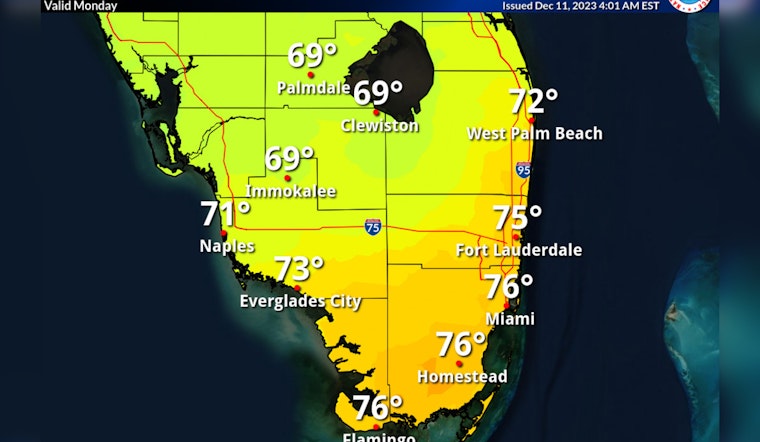
South Floridians are pulling out their light jackets as a cold front arrives, driving temperatures down by about 10 degrees compared to the weekend's warmth. This shift in weather, according to the National Weather Service, spells a cooler and breezy Monday, with the high struggling to break the mid-70s barrier.
Today's sunny skies and northwest winds of up to 18 mph will give way to a mostly cloudy evening, with temperatures dipping down to an expected low of 62 degrees. As reported by Local 10 News, the morning kicked off in the upper 60s along with a chance for "a light shower or sprinkle." A dry afternoon ensued, marked by patchy clouds and those brisk northern breezes.
Looking ahead into the week, Tuesday maintains the trend with partly sunny temperatures cresting near 78 degrees. However, the weather takes a turn Wednesday, with a 70% chance of precipitation and potential thunderstorms, as winds intensify signaling turbulent times ahead for outdoor activity and marine conditions alike.
The latter part of the week doesn't seem very bright for beachgoers or boaters. The threat of showers and thunderstorms prevails from Wednesday night into the weekend, with chances of precipitation hovering around 60%. For those braving the waters, a caution is in place. Both sites warn of a "High Rip Current Risk" along with deteriorating conditions suitable only for the most experienced mariners.


