Chicago residents are bracing for an erratic weather pattern starting today, with the National Weather Service in Chicago/Romeoville issuing a hazardous weather outlook that anticipates a mixed bag of conditions including thunderstorms, potential severe weather, and a notable shift from today’s hot and humid situation to cooler climes in the coming days. The forecast, detailed on the outlook, brings attention to a "limited thunderstorm risk," where some storms could reach severity levels this afternoon and evening, with possible hazards such as a tornado risk and hail up to quarter size.
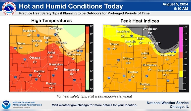
Today will be hot and steamy especially southeast of Interstate 90. Practice heat safety tips if planning to be outdoors for prolonged periods of time! #ILwx #INwx pic.twitter.com/84xBfLQUoY
— NWS Chicago (@NWSChicago) August 5, 2024
The weather narrative unfolds with today's high reaching nearly 85 degrees amid swirls of uncertainty, as a chance of showers and thunderstorms threaten to punctuate the skyline before noon and then again after 2 pm, as per the National Weather Service.
The uncertain times extend into the night with an increased 40 percent chance of showers and thunderstorms paving the way for a cooler Tuesday, marked by breezy conditions and high waves at southern Lake Michigan beaches that pose a high swim risk; come Wednesday, more stable weather is anticipated to return under mostly sunny skies, hinting at a respite and a gentle slide into the weekend, as reported by the National Weather Service.
According to the NWS Chicago, today due to the severe heat especially southeast of Interstate 90.


