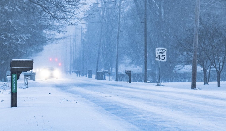
Friday morning commuters in Central Indiana should be prepared for slick, snow-covered roads as the National Weather Service (NWS) Indianapolis predicts snow showers continuing past the dawn hours. According to an alert issued by NWS, there's a high probability of "light snow accumulations of less than an inch" which could pose minor travel impacts across the region, with localities in east-central Indiana potentially facing one to two inches of snow. Commuters are advised to allot extra travel time and exercise caution during their morning drive.
In a special weather statement, shared on the NWS website, experts forecasted that this weather event will primarily impact the area during early to mid-morning hours, stressing that timing of the heaviest snowfall may coincide with morning rush hour leading to potentially hazardous and slick travel conditions. While battling the elements, drivers navigated roads, some negotiating with the whims of nature, casting uncertain glances at the skies anticipating the next flurry.
Looking beyond today, the outlook seems less daunting. The NWS indicated that after the initial snowy onslaught, no major hazardous weather events are expected from Saturday through to the following Thursday. A mix of cloudy skies and sun is anticipated with daytime highs ranging from the low 30s to the mid-50s throughout the week. Nighttime conditions will chill down to lows in the mid-20s to low 40s, so local residents should stay prepared for cooler evenings.
Rain is likely during the week, with chances ranging from 30% to 50% starting Monday, so it’s a good idea to carry an umbrella. The NWS advises staying updated on weather conditions as the holidays approach. The workweek forecast suggests varying chances of rain, reflecting the unpredictability of holiday plans.


