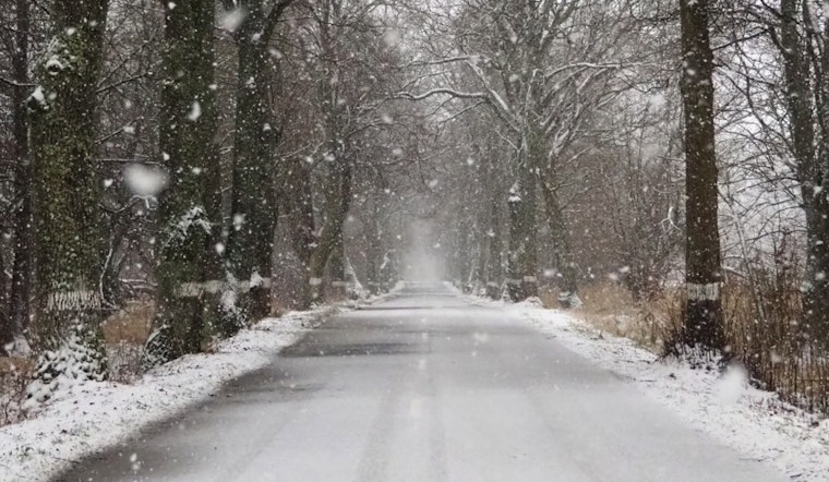
Cold weather and icy conditions are set to continue as Charlotte and the surrounding Piedmont and foothills regions of North Carolina navigate the aftermath of an early December snowfall. According to a Special Weather Statement by the National Weather Service in Charlotte, indicates that snow showers have reduced to flurries and additional snow accumulations are not expected at this time. However, up to 1.5 inches of snow were recorded in parts of the region overnight, with temperatures plunging into the 20s, raising concerns for commuters about slick and potentially hazardous road conditions, especially on elevated surfaces like bridges and overpasses.
Officials urged caution for those traveling, stating, "Temperatures have fallen into the 20s across much of the area this morning, so any lingering snow-covered or previously wet roads are likely to be slick and hazardous, especially on bridges and overpasses". The statement, which cautioned that roads just north and northwest of Charlotte could be particularly treacherous, pointed out the necessity for extra travel time. According to the Special Weather Statement by the NWS, temperatures are expected to rise above freezing by late morning, which may help reduce the current icy road dangers.
The frigid conditions come as part of a broader chilly spell that's expected to grip the area, spurring the National Weather Service to issue a Hazardous Weather Outlook. The outlook spans across northeast Georgia, the Piedmont and western North Carolina, as well as Upstate South Carolina, warming of cold weather persisting through midweek. A "hard freeze is likely each morning through Wednesday," possibly affecting commuters and those without adequate home heating solutions.
In response to the dropping temperatures, local schools and municipal services are bracing for the impacts, remaining vigilant while the freeze warnings are in effect. The public is advised to stay informed on the latest weather updates and travel advisories, as "icy roads are possible at the higher elevations and parts of the NC
Piedmont that received accumulating snow this morning," which are regions accustomed to battling the whims of temperate but at times unpredictable Southern weather patterns, as per the Hazardous Weather Outlook from the NWS. While no spotter activations are currently expected, residents are encouraged to report severe weather conditions to local authorities.


