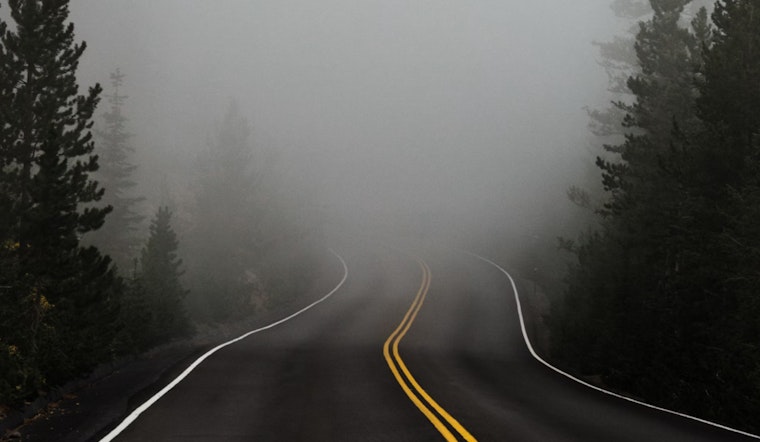
The National Weather Service in Indianapolis issued an early morning advisory for dense fog across central Indiana, cautioning residents and travelers alike of reduced visibilities to a quarter mile or less. This thick fog was expected to linger until mid-morning, with potential impact on the day's commute. "Areas of dense fog have developed across central Indiana with visibilities reduced to a quarter mile or less. These conditions could persist through mid-morning," the National Weather Service stated. Drivers are advised to slow down, utilize low-beam headlights, and keep a generous distance from the vehicle ahead.
Later today, the fog is projected to give way to partly sunny skies, with high temperatures nearing 47 degrees Fahrenheit. However, an abrupt shift is expected tonight as the weather pattern turns, bringing a slight chance of snow showers and a dip in temperature down to around 26 degrees. Despite the forecast indicating a minimal 20% likelihood for snow tonight, motorists should be ready to navigate potentially tricky conditions. Calm winds are anticipated to turn northwest, coming in at around 8 mph.
Looking ahead into the week, the outlook turns brisk with scattered snow showers tomorrow afternoon, and a 50% chance of precipitation. A combination of increasing clouds and high winds—with gusts reaching potentially up to 28 mph—could significantly reduce visibility. "Scattered snow showers are expected Wednesday afternoon and evening, with the potential for snow squalls as well," detailed the National Weather Service. The hazardous conditions are set to continue with temperatures plummeting tomorrow night to a frosty 15 degrees and winds gusting as high as 33 mph.
For the late week forecast, Thursday promises sunny skies but with high temperatures struggling to cross the 25-degree mark. Friday's weather patterns are characterized by partly sunny conditions morphing into likely showers in the night, with over a 60% chance of precipitation. The weekend seems to hold no respite from precipitation, with an 80% likelihood of showers on Saturday, potentially impacting outdoor activities and weekend plans. The National Weather Service encapsulates this in the Hazardous Weather Outlook, stating, "Spotter reports of snowfall and conditions would be appreciated Wednesday afternoon and evening." Clearly, the week ahead appears to be a mix of fleeting clarity and anticipated storms, both in skies and potentially on roads.
The full week's weather patterns and the effects on central Indiana are thoroughly outlined on the National Weather Service website.


