Chicago finds itself under a deluge today, with the National Weather Service forecasting an 80% chance of showers and thunderstorms, bringing temperatures down to about 72 degrees by the late afternoon. The wind, coming in from the north northeast, is expected to blow between 5 to 15 mph, with gusts that could reach up to 20 mph. The NWS also warns of possible new rainfall amounts between a quarter and half an inch.
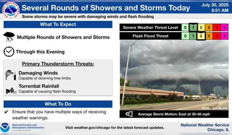
With a flash flood watch in effect for all of northeastern Illinois and northwest Indiana beginning at 1 p.m., the threat of severe weather looms. According to an NBC Chicago report, storms could bring another 1 to 2 inches of rainfall, raising concerns for flash floods—especially since by around 1 p.m., downpours are expected to engulf the Chicago area.
The NBC 5 Storm Team anticipates that these conditions may persist with widespread rain expected to continue through midnight and linger into Thursday morning. As the storms approach, the city braces for the possibility of severe weather, including risks of damaging wind gusts up to 60 miles per hour. The temperature differential will also be noticeable with cooler air moving in towards the end of the week, dropping readings into the 70s.
Additionally, beachgoers and mariners will face dangerous conditions along southern Lake Michigan beaches. Starting Wednesday, high waves and hazardous boating conditions are anticipated to pair with life-threatening currents and last through Friday, NBC Chicago notes. Despite the tempestuous weather, the weekend is forecasted to bring some respite, with sunny skies and temperatures hovering in the upper 70s and low 80s.


