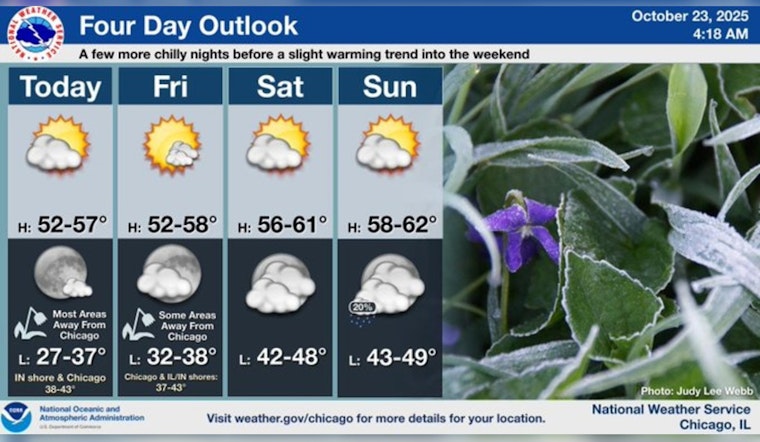
Residents of Chicago can look forward to a chilly but dry end to the week, with forecasters predicting clear skies and a notable dip in temperatures starting tonight. According to the National Weather Service, today's temperatures will reach a high near 53 degrees with a west-northwest wind blowing 10 to 15 mph. Gusts could reach as high as 20 mph, providing a brisk but sunny day.
Tonight, the temperatures are expected to plummet to the 30s, and some areas could experience lows in the upper 20s. "Tonight under clear skies with light winds, temperatures will freefall deep into the 30s over much of our viewing area with the exception of the urban heat island," FOX 32 Chicago reports. In response to these predictions, a freeze warning has been issued for late tonight into Friday morning for all but central Cook County.
The weekend should present a dry reprieve with sunny conditions persisting. On Friday, Chicagoans can expect more sun with highs around 53 and lighter northwest winds around 5 mph. Saturday continues the trend with mostly sunny skies and a high near 57, as reported by the National Weather Service. The mild weather is set to last through the weekend, with Sunday projected to be partly sunny and peaking near 59 degrees.
As the new week begins, Monday is projected to stay dry with temperatures again hovering in the upper 50s. However, clouds are expected to gather as Chicago approaches midweek. "Showers will be possible Tuesday and Wednesday with highs in the 50s" FOX 32 Chicago informs us. While Tuesday brings a chance of showers and partly sunny conditions, Wednesday could also see a chance of rain amidst the mostly cloudy skies.


