The National Weather Service San Francisco Bay Area has issued multiple advisories affecting those planning to visit the beaches or travel through several fog-affected valleys this morning. According to the NWS San Francisco, a Beach Hazards Statement will remain effective through 10 AM Tuesday due to elevated risks of sneaker waves and rip currents. Beachgoers are cautioned against the unpredictable high-breaking waves expected to range between 13 and 18 feet.
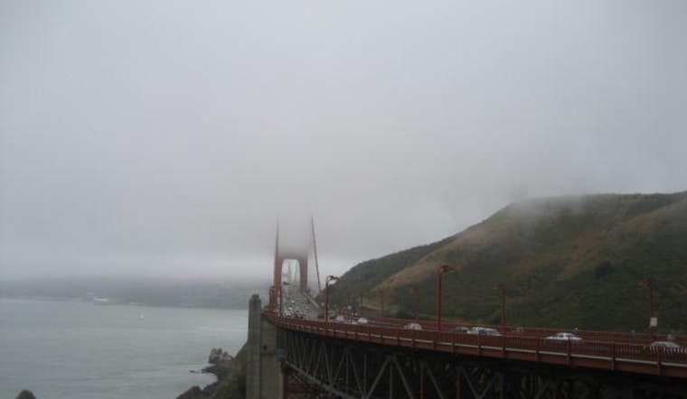
In addition to coastal concerns, the NWS has also implemented a Dense Fog Advisory for the southern Salinas Valley, as well as parts of the San Francisco Bay Area. Affected residents and travelers are advised to maintain a slow pace, allow extra travel time, keep a safe following distance, and avoid using high-beam headlights to navigate through these areas safely. These advisories follow the development of fog overnight across the North Bay Interior Valleys and East Bay Interior Valleys, with the potential to further expand.
Dry and mild conditions are forecast to persist until the end of the week, with a cooling expected over the weekend as the next weather system approaches. Offshore winds are expected to become gusty on Sunday.
The Marine conditions have also been affected, with a Dense Fog Advisory in place for the SF Bay, North of the Bay Bridge, until 11 AM today. Mariners are encouraged to exercise caution when navigating these foggy areas. As the week progresses, high pressure will maintain its grip over the coastal waters with seas easing and northerly breezes ranging from gentle to moderate. "Winds will begin to increase again late week, building moderate to rough seas," according to the Area Forecast Discussion by the NWS San Francisco.


.jpg)