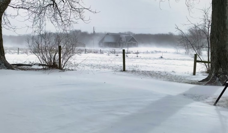
As the mercury plummets, residents across central Indiana are waking up to a frigid reality. The National Weather Service in Indianapolis has issued an Extreme Cold Warning, in effect until 11 AM EST this morning, with wind chills expected to reach as low as 23 below zero. The Cold Weather Advisory will continue from 11 AM today to 9 AM EST tomorrow, bringing with it wind chills as low as 21 below zero. This bone-chilling forecast isn't just uncomfortable, it's perilous, with risks of frostbite striking exposed skin in under 30 minutes.
In their urgent weather message, the NWS stressed the severity of these conditions, "The dangerously cold wind chills as low as 25 below zero could cause frostbite on exposed skin in as little as 30 minutes." Those venturing outside are advised to don multiple layers, a hat, face mask, and gloves. It's a stark drop in temperature that demands caution, preparedness, and warm layers. In these situations, even simple errands become daunting expeditions against the biting cold.
Looking ahead, the chill is set to persist. Despite sunny skies forecasted for today with a high near 9 degrees, the wind chill could make it feel as low as -17. The upcoming nights will offer little reprieve, with expected lows around -2 degrees and wind chills potentially hitting -12. Tomorrow brings hope for a warming trend, with a high near 25 and sunny conditions, but wind chill values will remain a concern at -13 in the early hours.
As the week rolls on, the climate teeters on the cusp of change with temperatures gradually climbing. Residents in Indianapolis and surrounding areas such as Lafayette, Anderson, and Terre Haute can anticipate partly sunny skies by midweek, and by Thursday, even the possibility of rain. However, with the turn to wetter weather, comes a return to milder temperatures—Thursday's high is anticipated at around 53 degrees, providing a much-needed reprieve from the brutal cold snap.
While the extreme conditions loom large, local authorities have not signaled for spotter activation. Nevertheless, the NWS maintains an active dialogue with the community, offering additional weather, hydrological, and climate information on their website for those seeking guidance amid these icy advisories.


