After a week of shivering through near-freezing overnight temperatures and making history with the region's first-ever Extreme Cold Warning, the Bay Area is about to get a whole lot friendlier. Just don't head to the beach quite yet.
The National Weather Service reports that high pressure building into the Intermountain West, combined with a coastal trough off California, will drive a 10-degree warmup between now and Friday. Both daytime highs and overnight lows will climb to about 10 degrees above normal as an "anomalously high amplitude longwave ridge" moves in from the Eastern Pacific Ocean. Translation: sunshine and pleasant temperatures are coming, and they're staying awhile.
Radiational Cooling Heaven (Or Hell, Depending on Your Perspective)
This Saturday morning, San Jose International Airport is forecast to drop to 35 degrees, matching the lows seen last Monday and Tuesday. But according to the National Weather Service, this isn't record-breaking territory. The airport's daily record low is 27 degrees, set way back in 1920, and forecasters give a 0% chance of that record being touched today.
The cold snap has more to do with conditions than air mass. "Calm, clear, and cool conditions with long nights is a match made in radiational cooling heaven," the National Weather Service explains. Some high clouds streaming in from a storm system in the Gulf of Alaska might provide a thin blanket, but satellite imagery suggests they're too wispy to meaningfully impact minimum temperatures. Cold Weather Advisories remain in effect until 9 AM Saturday for most of the Bay Area, with Extreme Cold Warnings continuing for interior Monterey County, San Benito County, and the eastern Santa Clara Hills.
A Welcomed Break After a Deluge
The upcoming dry spell isn't cause for concern; it's actually a relief. Just this week, California achieved something remarkable: for the first time in 25 years, not a single square mile of the state registered as dry on the U.S. Drought Monitor. As SFGATE reports, 100% of California is classified as free of drought conditions, with no areas listed as abnormally dry or experiencing any level of drought.
The last time the state reached that threshold was December 26, 2000, according to NWS meteorologist Dalton Behringer. As ABC7 News notes, measurements as of January 8 show virtually no dryness remaining, marking an "exceptionally wet period" that has filled the state's reservoirs to healthy levels. Seven of 12 major state-owned reservoirs now sit at 75% or higher capacity.
With that context, the forthcoming dry pattern makes more sense. The National Weather Service describes it as "more of a welcomed break from the watershed (and meteorologists alike) after the recent onslaught of impactful rain." Global ensemble forecasting models show the high-pressure ridge persisting through the end of next week, with both ECMWF and GFS ensembles indicating rain might return as early as the 20th, with likelihood increasing the following week.
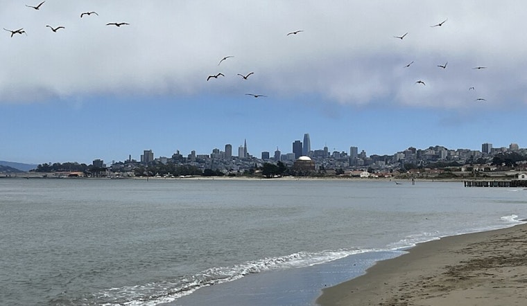
When Calm Skies Meet Dangerous Seas
Here's where the weather story gets counterintuitive: while conditions on land will be pleasant and calm, the ocean is about to turn nasty. A Beach Hazards Statement has been issued for the coast from Sonoma to Monterey counties, effective Sunday afternoon through Monday afternoon. A longer-period moderate swell will bring hazardous beach conditions with increased risk for rip currents, sneaker waves, and larger shore break, according to the National Weather Service.
As the San Francisco Chronicle explains, the surf is responding to a broader shift in the Pacific weather pattern. After weeks of storms aimed directly at California, high pressure is rebuilding over the northeastern Pacific, generating a powerful North Pacific swell. This creates a familiar but dangerous winter pattern: extended dry stretches under high pressure, punctuated by brief but energetic bursts of ocean swell.
The strongest waves are being generated far offshore, allowing long-period swell to reach the coast even as skies clear and winds turn offshore. "So conditions may look calm on land, but the ocean remains highly active," according to the San Francisco Chronicle. Additional west-northwest swells are expected into next week, keeping surf elevated through at least Thursday.
The NWS's Blunt Safety Message
The National Weather Service doesn't mince words about beach safety. "Stay off of jetties, piers, rocks, and other waterside infrastructure. Remain out of the water to avoid hazardous surf and NEVER turn your back on the ocean," the National Weather Service warns. That capital-letters emphasis on "NEVER" appears in virtually every beach hazards statement, a stark reminder that sneaker waves have claimed lives along this coastline.
Marine forecasters note that light to gentle breezes will prevail over coastal waters thanks to the large area of high pressure over the region. But that northwesterly swell building Sunday afternoon will produce rough sea state through at least Monday afternoon, with seas subsiding into Tuesday.
Aviation and Fog
In less dramatic weather news, dense fog impacted Sonoma County Airport earlier in the night, though high-level clouds put an end to that. The National Weather Service notes there's still a chance for fog to return given small dew point depression and light winds. Otherwise, VFR conditions are expected at all Bay Area terminals, with rather light and variable winds at times.
For San Francisco International Airport specifically, forecasters predict high clouds and light offshore to variable winds—about as benign as conditions get at SFO. Monterey Bay terminals can also expect VFR conditions through the forecast period.
A Pattern Shift Worth Appreciating
The transition from record-breaking wetness to extended dry conditions might seem jarring, but it's textbook California winter. The state alternates between atmospheric river deluges and high-pressure ridges, with each pattern typically lasting one to three weeks. What makes this particular pattern notable is its timing, arriving just as California reached drought-free status for the first time in a quarter-century.
As temperatures climb back to seasonal norms and then exceed them, Bay Area residents can look forward to pleasant afternoons and milder nights. Just save the beach trips for when that northwest swell finally subsides, probably sometime next week. Because while the skies might be clear and inviting, the ocean is playing by entirely different rules right now.


