If you've been enjoying the Bay Area's recent sunny streak, Thursday offers your best bet for warm temperatures before a gradual cooling trend sets in. The region is experiencing its warmest day in the current forecast period, with morning fog giving way to pleasant afternoon conditions—though Pacific coast beaches remain under hazardous surf warnings.
Today's high temperatures will reach the 60s across most of the Bay Area, with some interior areas potentially hitting the low 70s. According to the National Weather Service, the Santa Cruz Mountains and southern Santa Clara Valley could see temperatures climbing to 70-75 degrees, while Monterey and San Benito counties are expected to experience widespread 70s. A few interior areas in southern Monterey County might even break 80 degrees this afternoon—a notable departure from the recent cold spell that brought freezing temperatures to parts of the region earlier this month.
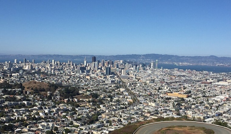
Morning Fog Lingers in Valleys
The morning started with fairly consistent fog across the Delta and interior valleys, particularly around the Russian River in Sonoma County. The National Weather Service noted that this fog appears "more uniform than the previous night" and is "more defined on satellite," suggesting it could persist longer into the morning than in recent days. After the fog clears, the region is set for another sunny day driven by the mostly dry air mass currently dominating the area.
These warm, dry conditions have contributed to what may become one of the driest Januarys on record for the Bay Area, as reported by Hoodline. The extended dry spell comes after California achieved a remarkable milestone: for the first time in 25 years, not a single square mile of the state registered as dry on the U.S. Drought Monitor, thanks to an earlier onslaught of impactful rain that left reservoirs well-stocked.
Cooling Trend Through Weekend
While Thursday represents the peak warmth, temperatures will start a gradual decline heading into the weekend. The ridge of high pressure that has been keeping conditions stable and sunny is expected to narrow, allowing for slight cooling in high temperatures while morning lows remain relatively steady. By Sunday, the orientation of the ridge could allow for a very weak onshore flow at the immediate coast, potentially bringing back a shallow marine layer. According to the National Weather Service, foggy mornings could return Sunday and into next week, though the lingering dry conditions and some thermal interference from passing high clouds might limit fog development.
The cooling trend is expected to continue through next week, with daytime temperatures gradually dropping while overnight lows see only slight variations. Temperatures will quickly cool after sunset tonight, with the mostly dry air mass allowing the warmest valleys to fall back into the mid to low 40s overnight, while some mountain areas will experience a weak thermal belt, leading to lows in the mid 50s among the peaks.
Beach Hazards Continue
Despite the pleasant inland weather, hazardous beach conditions remain in effect at all Pacific Coast beaches through Thursday evening. The NWS has issued a Beach Hazards Statement warning of sneaker waves, strong rip currents, and large breaking waves of 7 to 12 feet. These sneaker waves—potentially deadly waves that suddenly surge much farther up the beach than expected—can sweep beach-goers into the ocean, roll logs and heavy debris, and result in cold water immersion with sea surface temperatures hovering around 55 degrees.
The beach hazard warnings have been a consistent presence in recent weeks, with The Mercury News reporting similar conditions throughout January. Earlier this month, the San Francisco Chronicle documented wave heights reaching 15 to 20-plus feet during a high surf advisory, with forecasters warning that long-period swells arrive with uneven spacing, meaning several smaller waves can be followed by a sudden, much larger surge.
Authorities strongly advise beachgoers to remain out of the water, stay off waterside infrastructure such as jetties, piers, and rocks, and never turn their back on the ocean.
Looking Ahead: Pattern Shift Possible
In the longer-term forecast, models are showing better agreement on a potential breaking of the current ridge pattern toward the end of next week. A strong trough is expected to deepen from the north, with its axis falling well to the east of the Bay Area. While this could be enough to flatten the ridge over the West Coast, the exact impacts remain uncertain. Some model outputs suggest a weak low or cold front could pass through the area during this flattening, potentially bringing light rain. Other models place the weak low much farther inland, which could mean stronger offshore winds and increased dry conditions instead.
This uncertainty highlights the challenges of long-range forecasting, particularly after such an extended period of stable high pressure. "This all to say that while the longer term forecast starts to show a slightly clearer picture, there can still be some interesting variations that could lead to very different weather," noted the National Weather Service, encouraging residents to check back for updates as the forecast evolves.
Marine and Aviation Conditions
Gentle to moderate northerly breezes will veer through the morning to become offshore through Saturday before northerly winds return Sunday. Moderate seas will prevail through the week, with the exception of the northwestern portion of the waters where rough seas are expected Thursday. For aviation, VFR conditions are expected to prevail by this afternoon after morning fog clears, with easterly to northeasterly winds continuing at San Francisco International Airport. Tule fog from the Central Valley has been encroaching the East Bay, threatening terminals like Livermore and Oakland with reduced visibilities, though high confidence exists for VFR conditions by afternoon.
For Bay Area residents planning outdoor activities, Thursday offers ideal conditions to enjoy the warmth before the gradual cooling begins—just make sure to stay well away from the coastline where ocean hazards persist.


