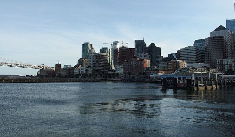
San Francisco’s transit bosses are drawing up a long game for the Embarcadero, and they are asking the people who use it every day to help call the plays. The Embarcadero Connectivity Plan is a long‑range effort to keep the waterfront moving while the Port and federal engineers plan flood defenses. The outreach covers the stretch from Aquatic Park to Mission Creek and aims to juggle daily commutes, tourist crowds, and bike and pedestrian routes during decades‑long resilience projects.
How SFMTA Asked for Feedback
Today, the agency took to X to invite the public into the process, flagging early phases of the plan and steering people to an online survey and community meetings. You can see the original post from the agency at SFMTA.
We want your feedback on early phases of the Embarcadero Connectivity Plan! This long-range transportation plan aims to create an improved & resilient waterfront transportation system in support of the Port of San Francisco's Waterfront Flood Study.
— SFMTA (@SFMTA_Muni) January 26, 2026
1/https://t.co/idhKZHqIsB
Where the Plan Will Look and What It Covers
According to the project overview, the plan area runs along the waterfront from Aquatic Park to Mission Creek and includes nearby neighborhoods such as North Beach, Chinatown, the Financial District, SoMa, and South Beach. The SFMTA lists key transportation pieces in the mix: the Ferry Building and ferry terminals, the F Market & Wharves streetcar, BART, and Muni’s Embarcadero Station, along with surrounding streets, bikeways, and promenades.
The agency is inviting people to take an online survey or request meetings with the project team by emailing [email protected]. Early outreach, as outlined by the SFMTA, will help shape the alternatives planners will study next.
Draft Flood Plan Raises the Stakes
The Port of San Francisco and the U.S. Army Corps of Engineers recently rolled out a Draft Plan for the San Francisco Waterfront Flood Study that sketches where coastal flood defenses could be built and how construction might be phased. The Draft Plan points to options such as raising the seawall along the Embarcadero and attaches early cost estimates in the low double-digit billions. It also kicks off a federal environmental review and public comment process.
For the draft recommendations and technical documents, see the U.S. Army Corps of Engineers.
Why Riders and Nearby Neighborhoods Should Care
Experts say the Embarcadero’s century‑old seawall is vulnerable to sea‑level rise and storm surges, which could translate into repeated service interruptions for ferries, Muni streetcars, and BART. As reported by KQED, engineers and scientists warn that upgrades will have to walk a tightrope between protecting historic piers and preserving daily transit access.
The SFMTA notes that the waterfront carries transportation infrastructure used by hundreds of thousands of people each week, which is why the agency is tying this connectivity study directly to the Port’s flood planning work, according to the SFMTA.
What Comes Next
The SFMTA timeline shows work to develop and analyze alternatives running through Fall 2026, followed by draft and final plan development into Fall 2027. The agency says there will be more chances for public review and comment as specific design options get refined.
For now, the project materials and online hub are the main places to find the survey, sign up for updates, and request meetings with the project team.


.jpg)