Out on the Pacific, Bay Area scientists say one of the best warning systems for a changing ocean is not a fancy buoy or a high-tech satellite. It is the fishing boats themselves. By treating vessels' satellite tracks like floating sensors, researchers at UC Santa Cruz report they can spot shifts in tuna distribution faster than traditional temperature-based indicators. If the approach catches on, it could give coastal communities and fishery managers earlier notice of marine heatwave disruptions that shutter fisheries and strain local economies.
Study finds fishermen signal tuna shifts first
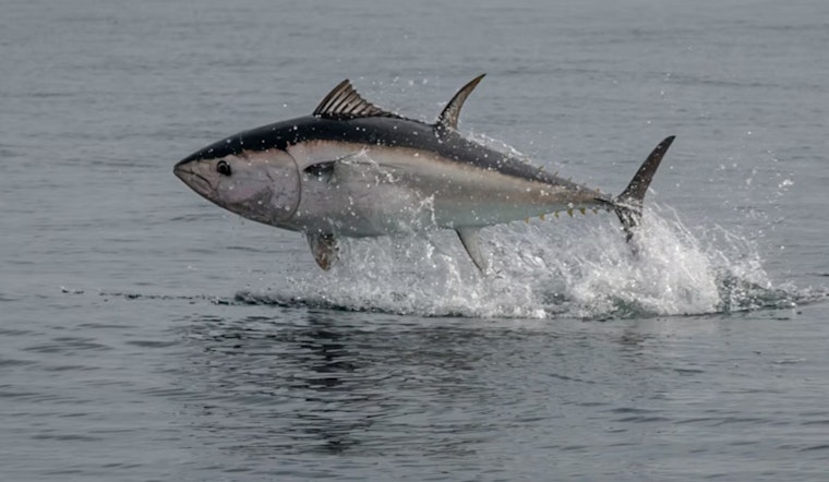
In a study published in the Proceedings of the National Academy of Sciences, UC Santa Cruz researchers analyzed roughly one million Vessel Monitoring System position reports from about 600 U.S. vessels and found VMS-derived fishing effort predicted extreme northward and inshore shifts in albacore and Pacific bluefin tuna up to six times better than sea-surface-temperature anomalies. The paper, published Dec. 22, 2025, also reports that fleet movements signaled reduced albacore availability during 2023 more than a year before governors requested federal disaster assistance for the fishery. The authors frame the technique as treating fishing fleets as ecosystem sentinels that can speed management response to abrupt ecological change.
How the tracking works
The method stitches together government VMS feeds with Automatic Identification System positions and satellite imagery to build a near-real-time picture of where fishing is happening and when vessels stop broadcasting. According to Global Fishing Watch, combining AIS, VMS and machine-learning detection of dark targets gives researchers a richer view of fishing activity than any single stream can. As reported by ABC7 San Francisco, Global Fishing Watch's team uses AI to classify billions of GPS positions so scientists can infer where target species are being located and pursued.
Why this matters for managers and local fisheries
NOAA already requires and collects VMS data for many U.S. fisheries and uses it to monitor closed areas and compliance, but those streams are primarily configured for enforcement rather than ecosystem alerts. Per NOAA Fisheries, VMS reports are transmitted at regular intervals and are subject to regional rules and confidentiality. UC Santa Cruz researchers say pairing those operational feeds with public datasets and landing receipts could give managers earlier, actionable warnings that fish and fleets are shifting, which could allow targeted relief or conservation before losses mount.
Caveats and next steps
The authors caution that policy, market and management actions, such as closures or quota changes, can create “noise” in fleet data, so VMS-based signals should not be used alone to make regulatory decisions. In a UC Santa Cruz news release, lead author Heather Welch said researchers have “so much data on fishing vessel activity” and emphasized the need to filter behavioral and policy-driven signals from true ecological responses. The paper calls for pilot programs, clearer data-sharing pathways and safeguards for vessel privacy so fleet-based sentinel systems can be tested without undermining enforcement or operator confidentiality.
What comes next
For Bay Area researchers and fisheries, the practical next steps are straightforward: run trials that combine VMS, AIS and shore-side landing data, and work out operational protocols that protect confidentiality while delivering timely alerts. Global Fishing Watch's public maps and algorithms offer one route to broader monitoring, and the PNAS study suggests those tools could move from research into everyday management practice. If managers and data stewards can reconcile privacy, enforcement and ecological uses, fleet-based sentinels may become a reliable early-warning system for an increasingly variable ocean.


