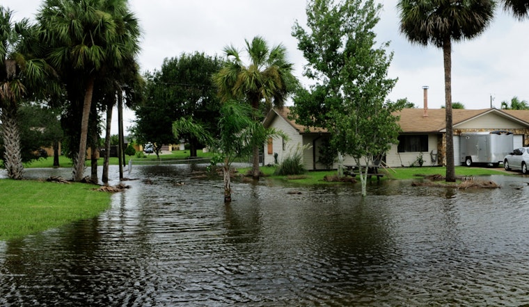
Portland is flat-out soaked this Thursday, March 12, with steady rain, low clouds and patchy fog keeping temperatures parked near 48°F at PDX. The wet stretch is locked in through Friday, with periods of heavy rain and spotty street flooding likely across low-lying neighborhoods. Flood watches now cover much of the metro along with nearby coast and foothills, and some smaller rivers have already climbed to minor or moderate flood stage. Drivers should expect slower-than-normal commutes, standing water on side streets, and at times reduced visibility on the main arterials.
What To Expect Today And Friday
Rain will stay steady and frequently heavy through Friday, with highs around 50°F Thursday before slipping into the mid-40s in the afternoon and then rising again overnight. New totals of roughly 1–2 inches are possible each day in the metro, with higher amounts in the Coast Range. Heavier bands could dump a quarter to a half inch in an hour in localized bursts, which will boost runoff and flood risk. Winds will be lighter in the lowlands but gusty on exposed ridgetops and along the coast, and marine conditions remain unsafe for small craft, according to NWS Portland.
Flood Watch And Rivers To Watch
The Flood Watch runs through Friday evening and covers Inner Portland Metro, the Tualatin Valley and nearby foothills. Forecasters warn that creeks like Johnson Creek and the Pudding River could approach bank-full levels. The Wilson and Trask rivers near Tillamook and the Grays River near Rosburg have already shown rises, with some gauges at minor to moderate flood stage, so residents near low-lying waterways should be ready to move vehicles and valuables to higher ground. This piece updates our March 11 forecast, see days of dumping rain for context on the atmospheric river.
Commutes, Transit And Boating
Drivers should avoid flooded streets and never try to drive through standing water; allow extra travel time and consider staying home if possible. Transit services may experience delays on wet, slow roads, so check TriMet service alerts before you go and expect bus and MAX runs to be slower than usual. Boaters and small-craft operators should stay out of exposed waters while advisories are posted and monitor local marine forecasts. We will update this post as warnings change; follow local officials and the NWS for the latest river and road information.


