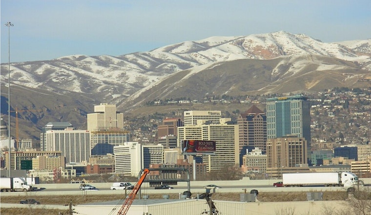
Mostly clear and about 36°F at Salt Lake City International Airport on Thursday, March 5, but the calm start is not sticking around for long. A strong cold front is on track to shove snow into the valley overnight and straight into the Thursday morning commute, with snow most likely before 11 a.m. A rain-and-snow mix could linger into the afternoon, so drivers should plan for slick spots on surface streets and build in some extra time for the Thursday morning rush.
Timing and Impacts
Forecasters expect the steadiest valley snow before 11 a.m. Thursday, March 5. From about 11 a.m. to 5 p.m., look for a mix of rain and snow, with a slight chance of thunderstorms late in the day. New valley rainfall totals are projected around a tenth to a quarter of an inch, while most valley snow amounts should stay under a half-inch. The real accumulation bullseye remains on the mountains. Winter Weather Advisories are posted for many northern Utah valleys and mountain zones from the early hours of Thursday into Friday evening, according to the National Weather Service.
Winds And Visibility
On the front’s leading edge, forecasters have already clocked pockets of gusty winds, with gusts topping 40 mph in some spots and isolated stronger gusts near the Great Salt Lake. When precipitation is coming down, expect periods of reduced visibility and brief MVFR to IFR conditions, especially under heavier bands. Winds should gradually back off later Thursday as the system shifts east.
Travel Advice
Plan on slower surface-street speeds and longer canyon drives during the Thursday morning commute. Leave earlier than usual and ease off the gas on wet or slushy ramps. If your plans take you into the mountains, bring traction devices and check both road conditions and flight status before heading out. For background on the setup and yesterday's timing update, see our earlier coverage, as per Hoodline.
Weekend Outlook
A weaker trailing wave will keep scattered mountain showers in play into Friday morning, but a drier and warmer pattern should build in for the weekend. Look for sunshine with highs near 47°F on Saturday, around 56°F on Sunday, and close to 63°F by Monday, March 9. Forecast updates are available from the National Weather Service.


