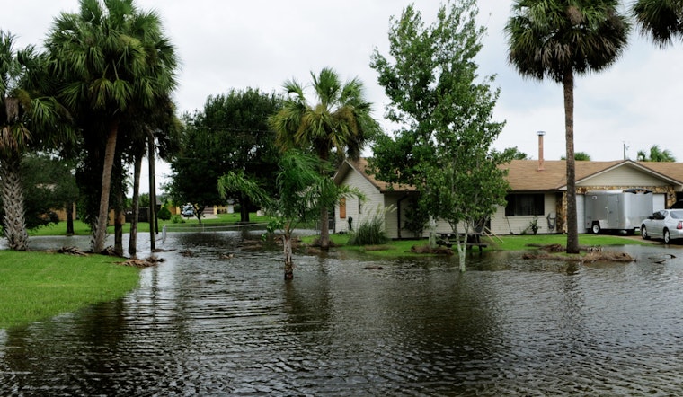
Thursday morning in Milwaukee is starting slow and soggy, with light rain and thick, patchy fog turning the commute into a crawl. Temperatures are hanging in the upper 50s near Mitchell Field (KMKE), and visibility is reduced along the lakeshore. Street flooding has already popped up in low-lying spots after earlier heavy rain, so drivers should plan for standing water on side streets and extra time behind the wheel.
Where the Flood Watch Applies
The National Weather Service has extended a Flood Watch through 1 p.m. CDT Thursday for far-southeast counties, while keeping the watch in effect through 7 a.m. for areas farther north and west. Locations that took the brunt of the heaviest rain earlier this week remain the quickest to flood, with a higher risk of rapid runoff and urban flooding. According to the National Weather Service Milwaukee, localized additional rainfall of 1 to 2 inches is possible in the strongest thunderstorms, with more widespread totals closer to a quarter to a half inch.
Foggy Mornings, Clearing Afternoons
Patchy fog and light showers are expected to ease through mid-morning, with conditions gradually improving into the afternoon as winds shift to the northeast and clouds begin to thin. Highs should land near 59°F in the city. That said, a brief downpour or isolated thunderstorm could still flare up and send a quick burst of runoff into already damp streets. For more background on this soggy setup and which neighborhoods usually see water first, check out our earlier fog-and-flood breakdown.
Another Round Friday Night
Forecasters are also keeping a close eye on a stronger round of storms expected Friday afternoon into Friday night. There is an elevated risk of damaging winds, severe thunderstorms, and heavier rainfall that could trigger flash flooding where the ground stays saturated. If you have outdoor plans Friday evening, be ready to move them or bring them inside, and watch for any watches or warnings that could be issued later in the day. Slow-moving storms may drop intense bursts of rain in a short window, raising the odds of urban and small-stream flooding.
What To Do Right Now
Turn around, and do not drive through flooded roadways; even a few inches of moving water can stall or sweep vehicles. Build in extra time for your commute, ease off the gas in fog-prone stretches near the lake, and secure any loose outdoor items before the next round of storms. Keep your phone charged and local alerts enabled so you get word of any new watches or warnings that develop through Thursday and into Friday night.


