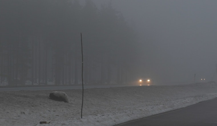
Oklahoma City woke up socked in on Wednesday, with dense fog, patchy drizzle and visibility down to around 2 miles while the airport hovered near 57°F. The murky start is expected to ease by mid-morning as the low clouds and light drizzle taper off. Skies should stay mostly cloudy through the afternoon, with a seasonable high near 72°F. South winds will stay on the breezy side, so the ride home could feel cooler and a bit blustery than the thermometer suggests.
Afternoon Winds Pick Up
Forecasters expect south winds of 9 to 16 mph this afternoon with gusts that could reach about 24 mph. The breeze does not really back off tonight either, with some spots seeing gusts near 26 mph. That is enough to kick up noticeable crosswinds on area highways and send loose lawn chairs skittering across the yard, so it is a good idea to secure patio furniture and lightweight items. Overnight lows stay on the mild side in the mid 60s across the metro.
Thursday Fire Weather Watch and Severe Risk
According to the National Weather Service in Norman, a Fire Weather Watch is posted for Thursday afternoon into the evening for portions of western Oklahoma, where gusty southwesterly winds and low humidity could help any fire spread quickly. The office is also watching a sharpening dryline that could set up a multi hazard situation. Any sustained storms that manage to develop to the east of it could bring large hail, damaging winds and an isolated tornado. This update follows an earlier warming and gusty pattern outlook from Hoodline that first flagged the breezier, warmer setup building into the week.
What To Know For Your Commute
Morning drivers should budget extra time for reduced visibility and slick pavement, especially near the airport and downtown, while midday trips look mostly cloudy and generally drier. A small umbrella will cover any brief drizzle, and drivers should be ready for gusty crosswinds along I 35 and I 40. High profile vehicles in particular may notice the stronger bursts. If you had outdoor burning or big yard projects on tap for Thursday, it is safer to postpone where local rules apply and to monitor any updated advisories.
Looking Ahead
Temperatures trend upward late this week, with highs close to 79°F on Thursday and pushing into the 80s by Friday and through the weekend. Scattered thunderstorm chances return from Friday into Sunday, and there are several windows where storms could turn strong to severe. Keep an eye on official forecasts as meteorologists fine tune the timing and placement of the most active weather.


