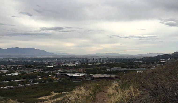
Salt Lake City started Monday on a calm note, with cool, clear skies and temperatures hovering around 37°F at the airport. The quiet stretch will not last long. A Pacific spring system is set to roll through tonight into Tuesday, bringing valley rain and fresh mountain snow. A Winter Weather Advisory is posted through 3 p.m. Tuesday for parts of the southern and central mountains, so canyon commuters should be ready for slower, sometimes slick travel.
Showers Tonight Into Tuesday
Rain showers are expected to spread into the valley tonight, with lows near 38°F and a few heavier bursts in the mix. Most neighborhoods will see light totals, roughly a tenth to a quarter of an inch. Before that, Monday offers a partly sunny window with highs in the upper 50s, followed by a return to scattered showers later in the afternoon and evening.
If you are planning errands or a commute in the rain, you can track timing and hourly details through the National Weather Service.
Where Snow Will Matter
For snow lovers and canyon drivers, the important cutoff is near 7,500 feet. Most accumulating snow is expected above that level, with the southern and central mountain ranges favored for the heaviest amounts. Forecasts are calling for about 3 to 8 inches in those zones, while the Tushars and a few higher peaks could quietly stack up more, with a non-trivial chance of 12 inches or higher at the most favored spots.
The system will move slowly enough that brief, intense bursts are possible, especially Monday night into Tuesday morning. Those higher-rate showers could deliver quick, localized jumps in snowfall, according to the latest forecast discussion.
Commuter And Airport Notes
In the valley, roads will be mostly wet rather than wintry. The real trouble spots are the canyons and higher seasonal routes where snow and slush can turn the drive into a slow crawl. If you are heading up Big or Little Cottonwood, build in extra time and be ready for conditions to change quickly as you climb.
Above 7,500 feet, some routes and passes may see plows and sanding crews out working, so carry chains if your plans include a trip up the canyon. At Salt Lake City International Airport, the main terminal sits on the northern edge of the steadiest bands. Most flights should operate on schedule, but low clouds and passing showers can slow ground operations, so it is still smart to show up early and confirm status with your airline before you head out.
Late-Week Freeze Risk
A second, colder system is lining up for later in the week. Forecasters are flagging a real chance of freezing overnight temperatures Thursday and Friday nights, which is bad news for tender plants and unprotected outdoor plumbing. Residents should plan to shield gardens and containers from the cold.
The late-week chill also bumps up the odds for another round of mountain snow and even some low-elevation flakes in a few spots. Keeping tabs on updated forecasts as the week moves along will be key. Simple prep goes a long way: move potted plants indoors, turn off or insulate irrigation lines, and pull up road cameras before any longer drives to avoid avoidable weather headaches.


