

























































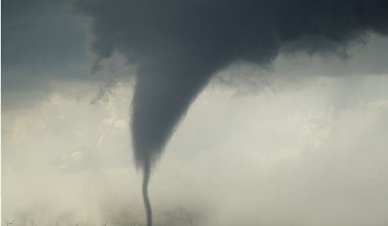
A tornado warning covered parts of Tooele County on Thursday evening after radar picked up rotation in a storm moving over the remote Skull Valley area, prompting the Stockton Fire Department to urge residents to get indoors immediately. The warning, in effect until 6 p.m., came with winds racing northeast at 50 miles per hour and the threat of flying debris capable of damaging roofs, windows and vehicles.
The National Weather Service Salt Lake City office expanded the tornado warning to cover Tooele County after reporting that severe thunderstorms in the area were capable of producing a tornado over Skull Valley, according to ABC4 Utah. Forecasters said weather radar indicated rotation in the wind, which raised the potential for a tornado to touch down. The station reported the storm was also likely to cause tree damage as it moved through the area.
The Stockton Fire Department advised the public to stay indoors, activate emergency alerts, and avoid traveling into the warned area to watch the storm unfold. The National Weather Service echoed that urgency, advising anyone outdoors, in mobile homes or in vehicles to move immediately to the closest substantial shelter and protect themselves from flying debris. Mobile homes, forecasters warned, could be damaged or destroyed outright in the event of a tornado touchdown.
Move to the Lowest Floor, Forecasters Warn
“Take cover now! Move to a basement or an interior room on the lowest floor of a sturdy building. Avoid windows,” the National Weather Service said, per the same ABC4 report. That guidance lines up with statewide protocols from Utah's own emergency management office. The Be Ready Utah preparedness program advises residents under a tornado warning to abandon vehicles and mobile homes entirely in favor of a sturdy building's lowest floor or basement, since both offer negligible protection against airborne debris.
The warning unfolded across one of Utah's most isolated corners. Skull Valley sits in central Tooele County between the Cedar and Stansbury mountains, an expanse of rural rangeland that includes the Skull Valley Indian Reservation and the Army's roughly 800,000-acre Dugway Proving Ground, according to background compiled by the U.S. Army. The area's sparse population and limited highway access complicate emergency communication whenever severe weather moves through.
Part of a Broader Monsoon Outbreak
Thursday's tornado warning did not develop in isolation. It emerged amid a wider regional storm setup that simultaneously triggered flash flood warnings and flash flood watches across southern and central Utah, according to KSL NewsRadio. The same monsoonal system brought heavy downpours and strong microburst gusts to several Utah counties on the same day.
Tornado warnings remain a rarity in Utah. The state averages only about 1.7 to 2 tornadoes per year statewide, according to National Weather Service statistics, because Utah's high altitude and arid climate generally limit the atmospheric instability that fuels rotating supercells. Tooele County specifically has logged just five documented tornadoes within its borders, and 12 within a 25-mile radius of Tooele City, since 1950 — all rated EF0 to EF2 with zero reported fatalities, per historical archives reviewed by VORTEX.
Why August Brings Utah's Twister Season
August is actually the peak month for Utah tornado activity, with 29 documented tornadoes recorded statewide since 1950 during the late-summer monsoon season, VORTEX data shows. Monsoonal moisture flowing north from the south increases humidity and thunderstorm instability across the state every August, feeding the kind of setup that produced Thursday's warning. Many of Utah's twisters are narrow landspout tornadoes that spin up from low-level surface rotation beneath growing cumulus clouds rather than the deep mesocyclones typical of Midwestern supercells, and they can form quickly over open desert ground before dissipating within minutes.
Utah has seen its share of tornado activity in the past two years. Earlier this year, the National Weather Service confirmed an EF-1 tornado touched down along the Rich–Cache county line, bringing 100 mph winds that snapped trees along a 0.44-mile path without causing injuries or structural home destruction. In September 2025, a rare tornado struck the Navajo Nation near Montezuma Creek and Blanding in San Juan County, destroying three homes, damaging infrastructure and displacing multiple families without human casualties, though local emergency managers noted afterward that residents lacked formal tornado response plans because twisters are so uncommon in the region.
Utah's deadliest tornado on record remains the F2 twister that struck downtown Salt Lake City on August 11, 1999, killing one person, injuring more than 80 and causing roughly $170 million in property damage, according to the National Weather Service. That event stands as the benchmark for how severe an urban Utah tornado can become, even as most tornadoes in the state remain brief and confined to open desert terrain like Skull Valley.





