Miami rolled into Sunday, May 24, 2026, warm and sticky, with temperatures already near 80°F and sunshine building fast. Most of the city will heat into the mid 80s as east winds strengthen and the Atlantic turns choppy. If Memorial Day weekend plans include the beach, timing your swim around lifeguard hours and flag warnings is key. The surf, not the sunshine, is the main trouble spot this holiday.
Afternoon Winds and Temperatures
Most neighborhoods are expected to top out in the mid 80s today with a high near 86°F while east winds increase into the 14 to 18 mph range, gusting to about 21 mph. There is a slight chance of a brief shower or an isolated thunderstorm this evening, but any rain should stay light and short lived. According to the National Weather Service, Memorial Day on Monday, May 25, looks very similar, with mostly sunny skies, hot conditions and a steady breeze.
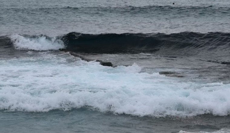
Rip Currents: Swim Near Lifeguards
The NWS has a Rip Current Statement in effect for coastal Broward County and coastal Miami Dade County through Tuesday evening, May 26, warning of dangerous rip currents that can pull even strong swimmers away from shore. Per the NWS forecast discussion, strong onshore flow and choppy surf will keep that risk elevated through at least May 26. If you get caught in a rip, float and point or wave for help, and only try to swim parallel to the beach if you are clearly making progress. Do not attempt to swim straight back in against the current.
Midweek Shift: Heavier Rain Possible
Forecast models and the NWS discussion show a push of deeper tropical moisture arriving Wednesday, May 27, which should increase the coverage of showers and storms by Thursday and Friday. The NWS notes that rain chances climb late in the week, with widespread downpours possible that could trigger brief urban flooding in some low lying spots. Keep an eye on updates if you have outdoor plans past Tuesday. High temperatures should hold in the mid 80s while overnight lows stay muggy in the upper 70s to low 80s.
Quick Safety Tips
At the beach, stick close to lifeguard stands and follow the posted flag system. It is safest to assume rip currents are in play through Tuesday, May 26. For plans away from the water, try to schedule activities for early morning or evening hours. Inland neighborhoods will feel hotter, with heat indices potentially reaching the upper 90s or low 100s. Bring plenty of water, find shade when you can and keep a backup plan in case conditions get uncomfortable.
More From Hoodline
We covered rising concerns about surf hazards in an earlier report. See rising rip current concerns for background on how persistent easterly winds have recently pushed surf dangers along the Atlantic coast. Today’s advisory simply stretches that pattern into the holiday weekend. Check the latest NWS forecast before heading out and let the lifeguards decide whether the water is open or off limits.


