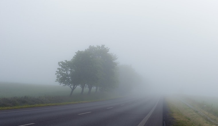
New Orleans wakes up warm and sticky this Monday, with temperatures hovering near 72°F and pockets of dense fog hugging the Pearl River Basin and parts of St. Tammany Parish. A Dense Fog Advisory is in place through 9 AM CDT on Monday, May 11, cutting visibility on low-lying roads and near waterways and setting the stage for afternoon showers and thunderstorms that could snarl the commute and drop brief heavy rain.
Morning Fog And Commute
The National Weather Service has issued the advisory for portions of the Mississippi coast, the Pearl River Basin and St. Tammany Parish, and drivers are urged to slow down, use low beams and budget extra time until the fog lifts. Visibility can fall off quickly in low spots and along canals and bridges, and forecasters expect most of the fog to burn off by midmorning as temperatures climb. Riders who depend on buses or paratransit should check local service alerts before heading out, since reduced visibility can ripple through the morning schedule.
Afternoon Storms And Flood Risk
Showers and thunderstorms are most likely from about noon to 4 PM Monday, May 11, with the odds peaking in the mid to late afternoon. Forecasters put today's rain chance near 60% and caution that some storms could bring brief heavy downpours, gusty winds and a few strong to marginally severe cells. Most spots will see only a few tenths to about a quarter inch of rain, yet isolated areas could pick up higher totals where storms stall over already saturated ground, which bumps up the risk of localized street flooding. Shift outdoor plans inside if storms build, avoid driving through standing water and boaters should stay off small craft while the storms are in the area.
Tonight And The Week Ahead
Rain chances fade overnight, with a chance of showers and thunderstorms lingering before 1 AM Tuesday and lows near 70°F. Skies are expected to clear Tuesday and Wednesday as a ridge returns and highs climb into the low to mid 80s. That drier spell should hold through midweek, although humidity and temperatures look set to rise again later in the week, bringing warmer, stickier conditions by Thursday and Friday. If you have outdoor plans late in the week or into the weekend, keep an eye out for forecast updates.
For background on the recent wet pattern, see this look at the recent rush-hour soaker.


.jpg)