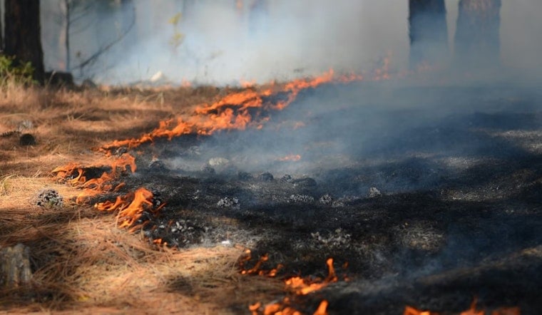
A new Northern California wildfire, dubbed the Zot Fire, was reported yesterday in Siskiyou County, burning on federal land managed by the U.S. Forest Service. The incident was first discovered at 10:44 AM, and by midafternoon, early updates indicated it had already been burning for roughly five hours. Officials initially listed the cause as natural, and no containment figures were available in the first round of public reports.
How The Fire Was Reported
According to The Sacramento Bee, the Zot Fire first appeared as an automated breaking item on the paper’s wildfire feed. The listing credited the National Interagency Fire Center as the incident’s original source entry and was posted and then updated later in the afternoon as new details came in.
Where The Zot Fire Is Burning
Initial reports place the Zot Fire on federal land overseen by the U.S. Forest Service. The agency has referenced a Zot-named start on its site in prior seasons, a reminder that in this corner of Northern California, even short-lived lightning or single-tree ignitions often get quick operational names while crews assess what they are dealing with. The Forest Service’s online materials include historical notes on local fire starts and firefighting activity in the area.
What Locals Should Know
At this early stage, public listings did not note any evacuation orders or threats to structures tied to the Zot Fire. The Siskiyou County Office of Emergency Services urges residents to enroll in ReadySiskiyou alerts, monitor current air quality and road conditions, and rely on county and federal channels for official updates. The county maintains a centralized fire updates page with sign-up information and alert details for anyone looking to stay ahead of changing conditions.
What To Watch Next
Siskiyou County’s fire hazard map and preparedness guidance highlight why even a small ignition gets close attention in the region’s mountains and valleys. With the right combination of fuels and steep terrain, a seemingly minor start can grow quickly. This story will be updated when the Forest Service, the county, or federal incident feeds release information on acreage, containment, or additional response details.


