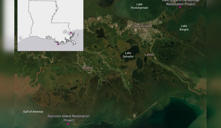
A federal-state restoration proposal would pour about $101.2 million into rebuilding roughly 1,320 acres of the East Orleans Landbridge near the Rigolets, reviving marsh platform and shoreline features that have been eating away for decades. The goal is to bring back habitat in the Pontchartrain Basin and strengthen a natural buffer between Lake Pontchartrain and neighborhoods east of New Orleans.
What's in the draft plan
The Louisiana Trustee Implementation Group's Draft Phase 2 Restoration Plan lays out several action alternatives and singles out a preferred option that leans on marsh creation paired with shoreline protection. According to the National Park Service, the TIG proposes allocating about $101.2 million to fully implement Alternative 4, which would place dredged sediment and install protective features to create approximately 1,320 acres of marsh in the East Orleans Landbridge.
Why it matters for New Orleans
The East Orleans Landbridge sits between Lake Pontchartrain and Lake Borgne and acts as a hydrologic corridor that helps knock down waves and storm surge before they reach shore. State planning documents and CWPPRA project pages show ongoing shoreline-stabilization and marsh-creation work in the same corridor, including a New Orleans landbridge project that targets about 271 acres to slow erosion and protect habitat and evacuation routes, per LaCoast.
Funding and next steps
The draft plan would draw on Deepwater Horizon trustee restoration allocations and related program funds to cover engineering, dredging and monitoring. The plan was posted for public comment in May, and the site listed a comment deadline of June 17, 2026. Trustees will consider the feedback before deciding whether to move to construction, according to Gulf Spill Restoration.
What residents should expect
If the project moves forward, residents and boaters can expect to see dredging barges, construction vessels and temporary navigational changes in and around the Rigolets and nearby shorelines during work phases. The draft RP/EA notes that those effects would be short term and forecasts long-term benefits for fisheries, migratory birds and reduced storm risk if restored marsh platforms and shoreline protections hold up over time, according to the plan's environmental analysis.
Photo and coverage
An aerial image taken from the U.S. Highway 90 Rigolets Bridge on June 17 and credited to David Grunfeld ran on NOLA.com, highlighting the scoured marsh and open-water patterns that the restoration is meant to address. The Draft RP/EA and supporting materials remain available online for readers who want to dig into the full technical designs and monitoring commitments.


