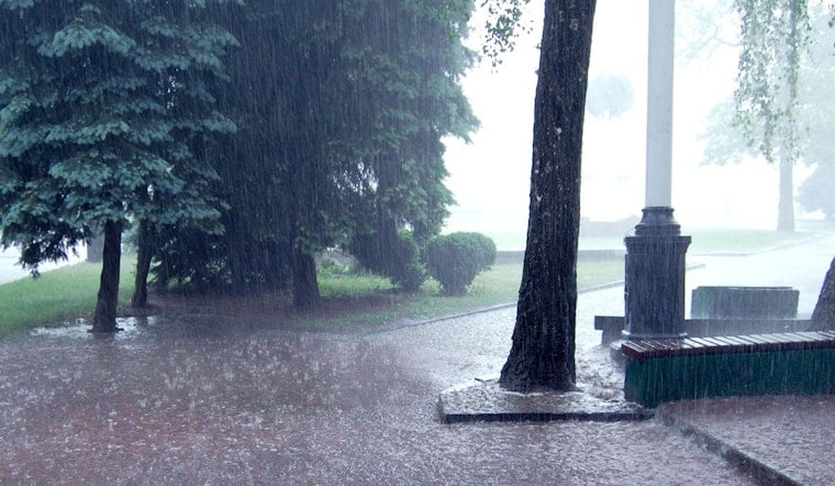
New Orleans wakes up warm, sticky and already on storm watch this morning, with partly cloudy skies and temperatures hovering near 79°F. Showers and thunderstorms are expected to pop by late morning and could hang around into the evening, pushing the daytime high to about 84°F. East to southeast winds will make the lakefront feel blustery and could nudge water onto low-lying streets at high tide. If you have outdoor plans, keep them loose; brief heavy downpours are very much in play.
Showers And Thunderstorms Today Into Saturday
Isolated showers early will become more widespread by late morning, with showers and thunderstorms likely between roughly 10 a.m. and 4 p.m. and again into the evening. Some storms could dump brief heavy rain. New rainfall amounts today are generally forecast between a tenth and a quarter of an inch, with tonight and Saturday carrying the risk of locally higher totals, up to a half inch or more in stronger cells, according to the National Weather Service.
Coastal Flooding And Marine Hazards
Coastal areas remain under a Coastal Flood Advisory into Friday evening, with minor tidal flooding of lots, parks and some streets possible during high tides. Boaters should expect choppy seas and rough conditions offshore, and small craft advisories remain likely as long as winds and seas stay elevated.
Marine And Wind Details
Look for sustained easterly winds near 20 - 25 knots over the coastal waters, with gusts topping 30 knots at times, while inland spots see east winds around 10 - 15 mph. Offshore seas are running 4 - 8 feet in places, so anyone planning time on the water is better off delaying or canceling those plans.
Commutes And Outdoor Plans
Afternoon and evening commutes could slow down in a hurry. Brief heavy downpours may cut visibility and leave standing water in low spots. City officials are urging drivers to move vehicles off blocks that are notorious for flooding and to "turn around, do not drown" if you meet deep water, as highlighted in our lakefront gusts and street flood fears June 4 forecast.
Weekend Outlook
Showers and storms should stay active through Saturday, with the greatest risk for locally heavy totals east of I-55 and along the I-10/I-12 corridor. Coverage is expected to back off a bit on Sunday. Early next week looks warmer and somewhat drier, with only isolated shower chances through Tuesday.
Before you head out, keep an eye on updated advisories this afternoon and into the weekend, and check the National Weather Service and local officials for the latest alerts and tide timing.


