If you spotted a bright yellow, surfboard-shaped robotic boat cruising around Lake Washington recently, you were not seeing things. That would be a new solar-powered ocean drone from NOAA's Pacific Marine Environmental Laboratory, getting its sea legs on local waters before heading out to the open Pacific to help sharpen forecasts for atmospheric rivers. After rounds of testing on Lake Washington, the craft has now shifted into Puget Sound as scientists ready it for missions off the West Coast.
What NOAA Is Testing
Chidong Zhang, an oceanographer with NOAA's PMEL, told KOMO the drone carries "a special sensor that can measure atmospheric water vapor," and the team plans to use those near-surface readings to sample atmospheric rivers. By blending the unmanned boat's atmospheric measurements with ocean data, researchers hope to improve the starting conditions inside the computer models forecasters depend on.
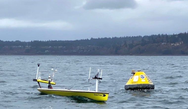
How the SeaTrac Works
NOAA's Pacific Marine Environmental Laboratory reports that the vehicle is fully solar powered and can stay at sea for months, giving teams long endurance without needing ship support. SeaTrac Systems, the platform's maker, notes its SP-48 has already been used to replace fixed buoys and to validate buoy and satellite data during calibration missions. On previous outings, SeaTrac's onboard cameras even caught a rocket launch on video, a flashy reminder of how remote sensors and imagery can extend scientists' observational reach.
Why This Matters for Forecasts
Atmospheric rivers, the long, narrow corridors of concentrated moisture that stream across the Pacific, supply much of the region's precipitation and are responsible for a big share of flood damage on the U.S. West Coast, according to NOAA's satellite service. Better, mobile observations across the ocean surface help reduce errors in those initial conditions that can otherwise grow into large forecast problems for heavy rain and flooding.
Next Steps
KOMO reports the craft has wrapped up trials on Lake Washington and is now undergoing testing in Puget Sound. If those evaluations continue to go well, NOAA could put the platform into mission service as soon as next year. Researchers say the drone can also be tasked with studying marine heat waves and harmful algal blooms, giving it scientific duties that go well beyond atmospheric river work.
Local Value
For Seattle and Puget Sound communities, a durable, mobile network of ocean drones could mean quicker detection when a fixed buoy fails and more lead time on flood warnings and coastal impacts. Scientists and agencies hope these platforms will plug observational gaps more quickly and at lower cost than traditional ship trips or buoy repairs, while feeding local forecasters richer data when the biggest West Coast storms roll in.


