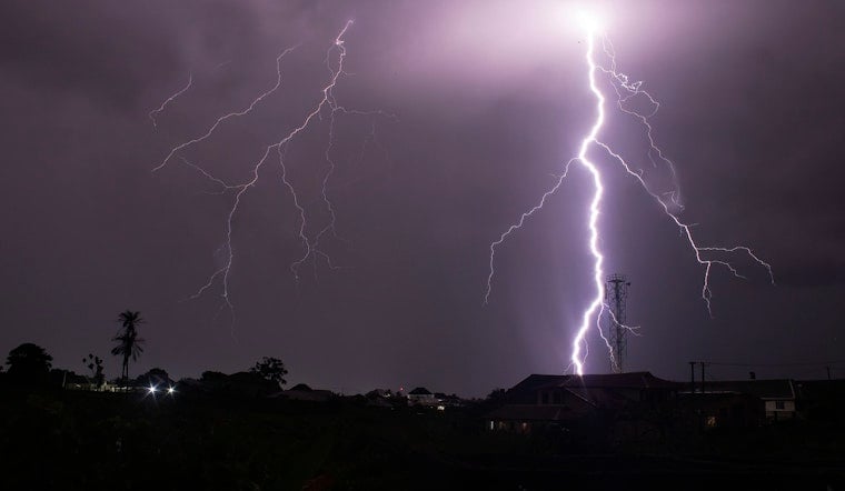
Oklahoma City is waking up mostly clear and muggy this Thursday morning, with temperatures hovering around 76°F at Will Rogers World Airport. It will be a warm one, with the afternoon expected to top out near 82°F on Thursday, June 18, and scattered showers and thunderstorms popping up through the day. The real trouble, though, is lining up for Thursday night, when heavier storms could dump brief but intense downpours and trigger localized flooding in low-lying spots.
Afternoon Timing And Winds
Showers and thunderstorms are on the table from about 7 a.m. through the early afternoon Thursday, but most neighborhoods will likely just see quick, spotty downpours. East winds should ramp up to around 6–16 mph, with gusts that could reach 24 mph and make any passing storm feel a bit more dramatic.
According to the National Weather Service in Norman, new rainfall amounts in these scattered cells are expected to land between a tenth and a quarter of an inch.
Tonight And Flood Risk
Rain chances rise sharply Thursday night, with forecasters eyeing the window from about 10 p.m. Thursday to 1 a.m. Friday, June 19, for the most persistent storms. There is a 70% chance of rain in this overnight period, with new rainfall totals projected around a quarter to a half inch. Isolated pockets could pick up more, enough to spark localized street and yard flooding, especially in low-lying areas and south of I-40.
Northeast winds will shift to about 8–16 mph with gusts near 24 mph, and some of the stronger storms could produce brief downbursts as they move through.
Plan Ahead
Keep an umbrella close and be ready to take it slow on the roads. If you run into standing water, avoid the temptation to test its depth; turn around, do not drown. If you have outdoor plans, it is a good idea to move them earlier on Thursday or indoors, and to secure loose items ahead of the gustier winds expected with storms.
Parts of the region were under a Heat Advisory yesterday, and the heat is not exactly gone for good. For cooling-center locations and tips on handling the hot, sticky pattern, check out our recent OKC heat advisory recap.
Forecast Snapshot
Thursday: High near 82°F with scattered storms during the day and a heavier round of rain and thunderstorms possible overnight.
Friday (Juneteenth): Cloudy with showers and thunderstorms likely before 1 p.m., high near 85°F.
Weekend: Saturday warms into the upper 80s, followed by a strong warm-up Sunday with highs near 97°F and renewed storm chances Sunday night.


