

























































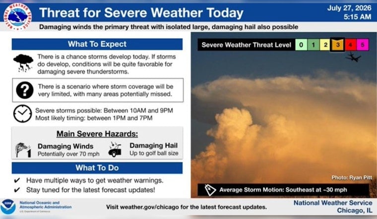
Chicago woke up in a full-on steam bath Monday morning, July 27, 2026, with dense fog, soupy humidity and barely-there visibility. At Midway, you can only see about 4 miles, temperatures are already near 79°F, and dew points are hanging in the upper 70s. It is sticky, it is breezy out of the southwest, and once the low clouds lift by late morning, the payoff is a hotter, stormier afternoon with highs near 89°F and the threat of quick-hitting, intense storms.
Storms This Morning Into Afternoon
Showers and thunderstorms are expected on and off through late morning into early afternoon, with the prime window running roughly from 7 a.m. to 1 p.m. A few of these storms could pack a punch, producing heavy downpours and gusty winds, with gusts up to 25 to 30 mph in the stronger cells.
Where storms repeatedly track over the same spot or briefly intensify, look for locally heavy rainfall totaling about a quarter to a half inch, along with the possibility of brief urban street flooding. According to NWS Chicago, the daytime chance of precipitation sits around 60 percent.
Heat And Where To Cool Off
On top of the storms, a Heat Advisory is in effect through 9 p.m. Monday, with humidity pushing heat index values into the low 100s this afternoon. That kind of “feels like” temperature makes extended outdoor exertion risky, especially for anyone sensitive to heat.
If you do not have reliable air conditioning, the city is urging residents to use public options. Check the city’s cooling center listings or call 311 to find air conditioned libraries, fieldhouses and other public spaces that are open as cooling hubs. Keep water handy, take it easy outside during the peak afternoon heat, and check in on older neighbors and anyone with health issues. For details, see the City of Chicago cooling centers map.
Lakefront And Travel Notes
After the daytime heat and storms, a cold front will swing through and flip winds to the north tonight. That shift is expected to kick up Lake Michigan, making for choppy conditions and dangerous currents for swimmers. Lifeguards are warning people to stay out of the water whenever warning flags are up.
Tuesday will feel like a different season, with highs in the mid 70s and a noticeably stronger north wind. Even so, early commuters may still run into low visibility fog and scattered downpours. If you have outdoor plans Monday evening, keep a backup indoor option in mind in case storms flare again, and be aware that gusty winds could briefly affect power or transit.
Before heading to the lakefront or planning time outside, keep an eye on updated local forecasts and any official advisories so you are not caught off guard by fast-changing conditions.





